Binntal/Alpe Devero

Location
Haut-Valais, in the Goms valley, hike taking place between Switzerland and Italy.

Descriptif
challenging hike over two days. The second stage presents passages with ladders, a complicated crossing of a morainic sector and a rather dizzying descent through several scree requiring very sure footing.

Total length
about 31 km. 1st stage 16 km, 2nd stage 15 km.

Walking time
approx. 10 to 11 a.m. 1st stage about 5 hours, 2nd stage about 6 hours.

Elevation + et –
+1,732 meters – 2056 meters. 1st stage + 799 m / – 874, 2nd stage + 933 / -1,182 m.
Altitude: between 1518 and 2481 meters

National hiking map 1:25’000
Binntal (Veglio-Devero), essential map because the Swiss mobile application does not work correctly on the Italian side of the hike.
Good indications are present all along the route.

Best period
from June to October. As soon as there is snow, the route of the second stage is very complicated and not recommended.

Difficulty
T3 with ladder passages, handrail with chain and 1 step of climbing level 3 (easy and not exposed). The two passages are equipped at the exit with a spit and belay pin, which makes it possible to secure the passage with a rope if necessary (10 meter rope, 6 mm is sufficient).
Comments: Swiss mobile data is not correct because the application does not work on the Italian side. For distances and travel times refer to the indications above.
Useful information
To take the alpine bus from Fäld to Brunnebiel, you must reserve your seat at the Binntal tourist office. Book early as places are limited. For people traveling by public transport, the alpine bus also departs from Ernen and/or Binn. In this case, be careful on the way back, because from Fäld (end point of the hike) to Binn there are several km of distance. This section can be avoided by passing through Maniboden instead of the Mässersee and reaching Binn directly. In this case count a good hour of walking more.
There is a large paying car park (about 10.— for 48 hours) in Fäld next to the alpine bus stop. From Fäld to Brunnebiel private traffic is strictly prohibited.
This route does not pass through the locality of Alpe Devero because from Crampiolo to Alpe Devero it takes about 45 minutes of additional walking for the 1st day and also for the second day. On the other hand, the hamlet of Crampiolo is typical and full of charm and offers many possibilities for accommodation.
Itinerary
Itinerary
1st step
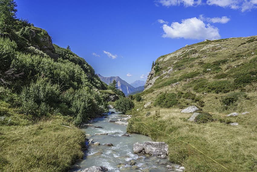
From Fäld in the Binntal, take the alpine bus to Brunnebiel. From there, head towards the Binntalhütte and continue towards the Albrunpass and the Italian border. Descend following the direction of Crampiolo to the first artificial lake and the place called Pianboglio (altitude point 1994). About 150 meters before the dyke of the lake turn left by a path for a short climb of about 100 meters to head towards Canaleccio (altitude point 1984). Continue towards Lago de Devero to follow it along the left bank to Crampiolo.
2nd stage
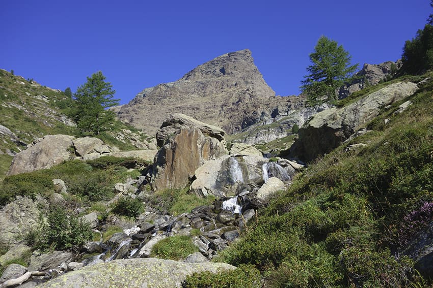
From Crampiolo, 20 meters after the last house, turn right towards Vallaro. At Vallaro, turn off towards Passo della Rossa. The route winds through a forest for about 1 km before joining the very difficult climb towards the passage of the ladders, the handrail and the passage of degree 3 (545 m. of elevation gain over 1.3 km!! !) and which joins the Passo della Rossa. After passing the ladders, the route crosses a very tormented morainic sector which requires a good observation of the road to follow until Passo della Rossa. From the pass, descend towards the Geisspfadsee which bypasses upstream and follow Binn, Mässersee by a rather complicated descent through several very exposed scree. Once at the Mässersee, continue towards Fäld along the right bank of the Mässerbach to reach the starting point.