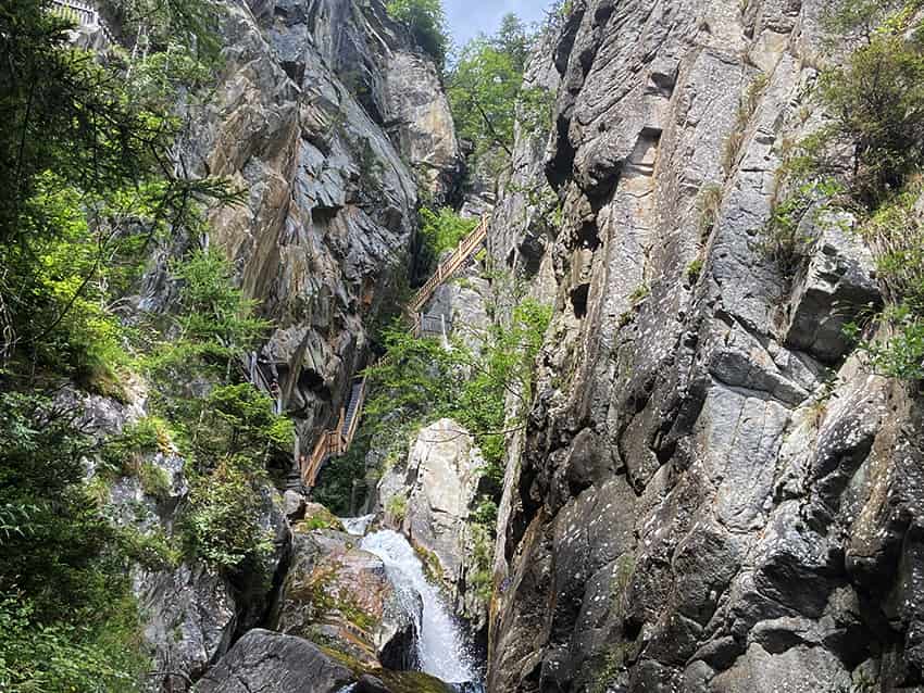
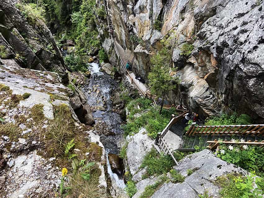
Gorges du Dailley

Location
Trient Valley, departure from the village of Les Granges after Salvan

Descriptif
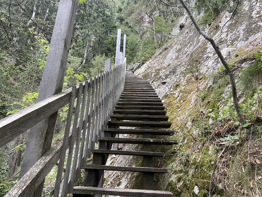
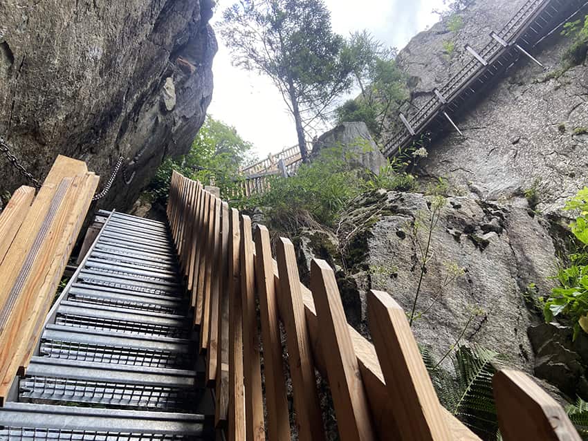
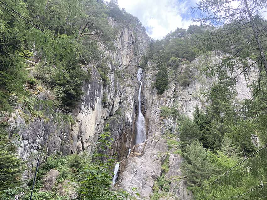
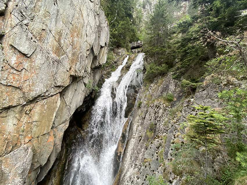
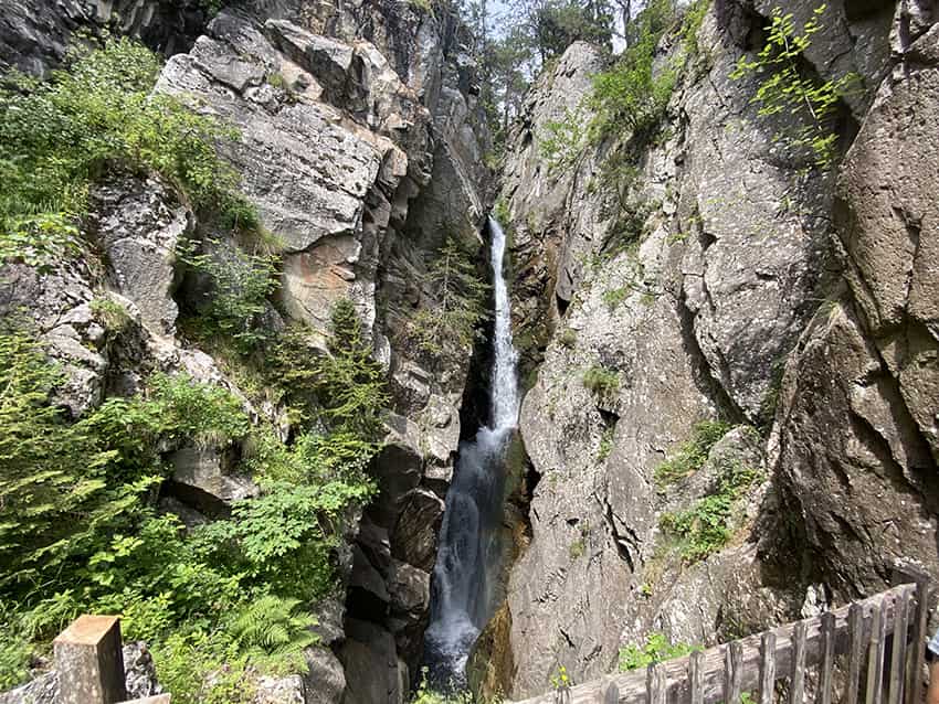
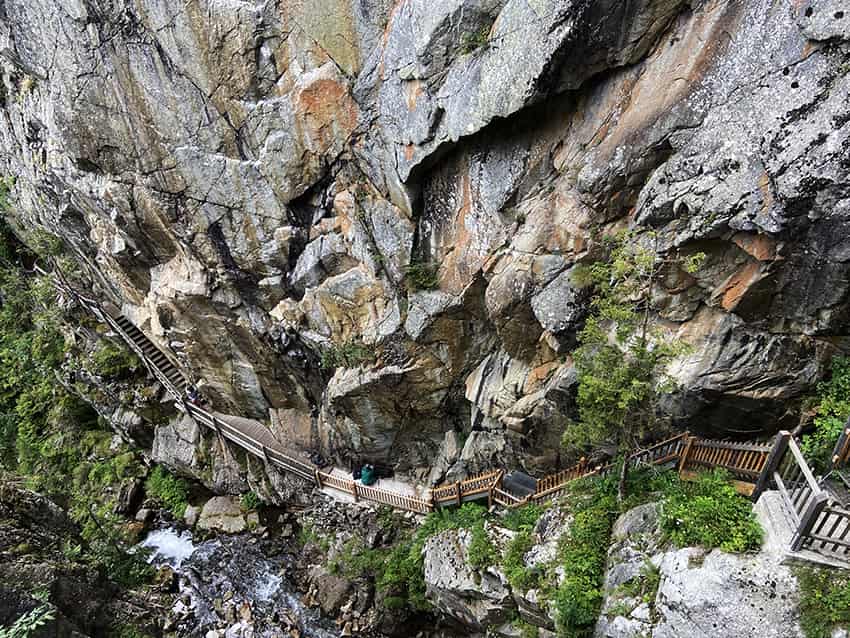
Spectacular hike along the Gorges du Dailley up 600 steps!

Total length
about 5,5 km

Walking time
about 2 to 3 hours

Elevation + et –
+/- 364 meters
Altitude: between 1067 and 1366 meters

National hiking map 1:50’000
282 Martigny

Best period
from mai to october

Difficulty
T3
Useful information
On weekends in summer, this hike is very busy and the car park may be full for people who arrive late. This hike requires a good physical condition and not suffer from vertigo.The village Les Granges is not served by public transport.
Itinerary
Departure
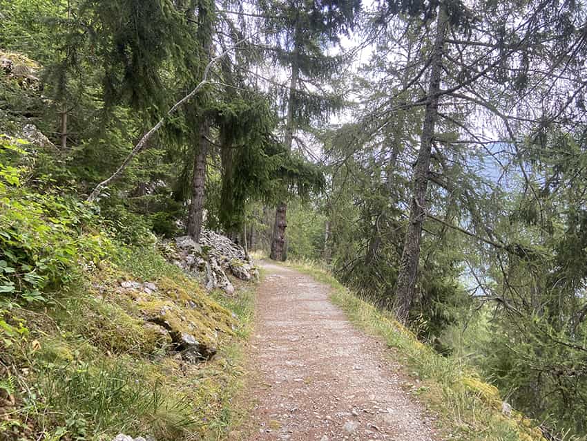
From the car park at the entrance to the village of Les Granges, follow the road upstream from the car park or cross the village to the starting point of the hike.
Itinerary
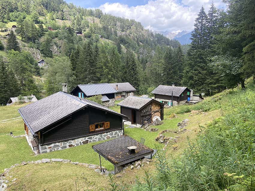
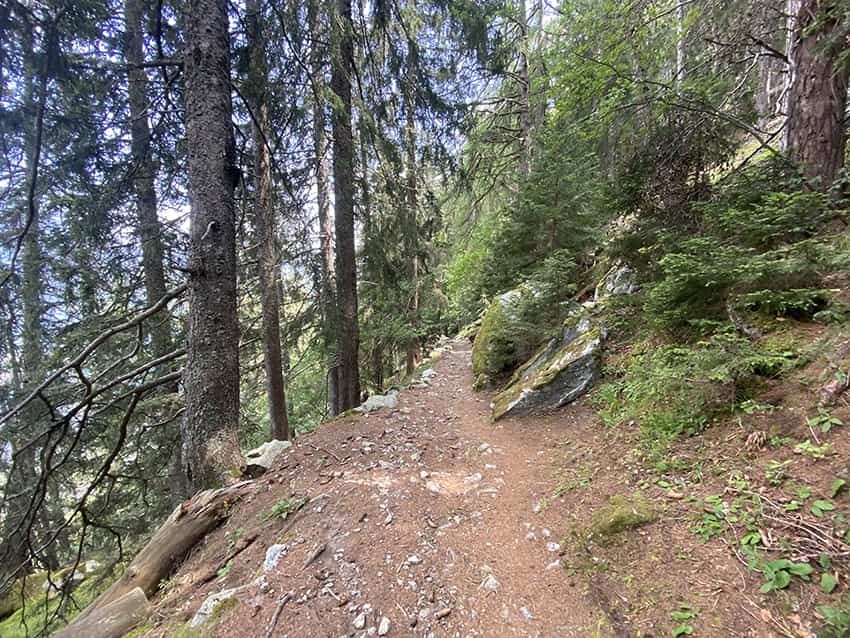
After the village of Les Granges, the route begins with an easy flat road to follow for about 1 km to the start of the stairs that go up along the gorges. The climb is spectacular and reaches the hamlet of Van d’en Bas. For the return, follow the road downstream from the Auberge du Vallon de Van until the indication Les Granges. After a short climb of 100 meters in altitude, the route descends on a good path to the starting point. During the descent, the path crosses the motorable road for 250 meters and a forest road a little lower. Always follow the “hiking path” signs.