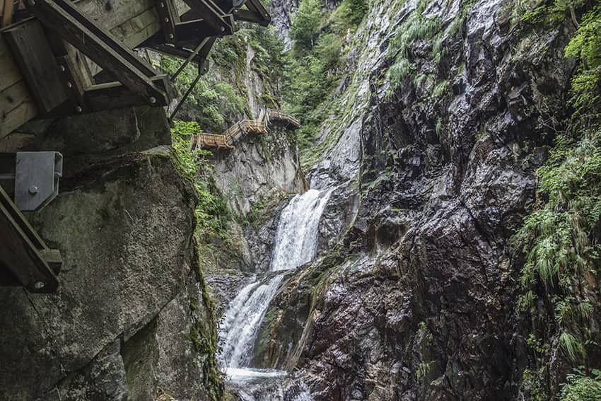
Gorges du Durnand

Location
Val de Bagnes, between the villages of Les Valettes and Le Borgeaud

Descriptif
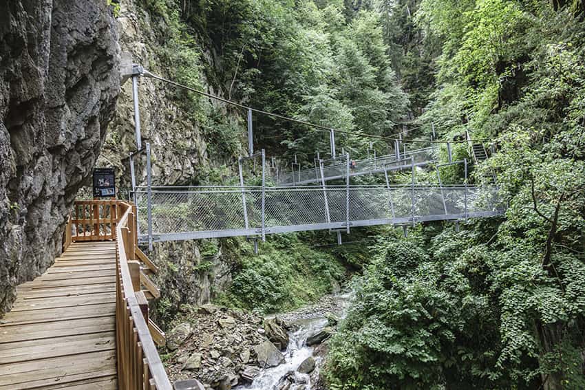
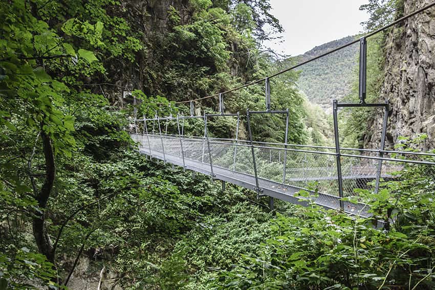
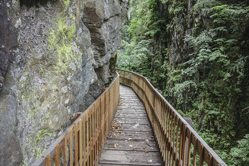
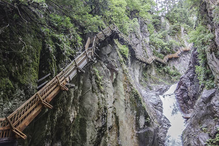
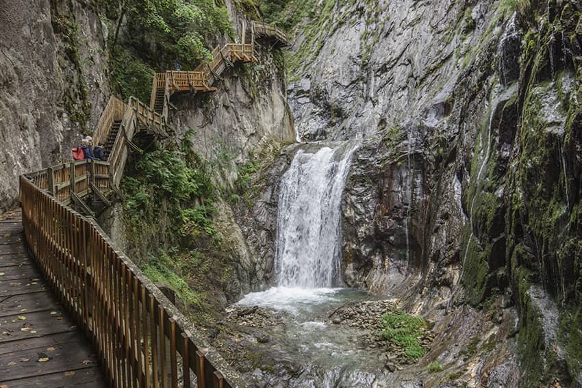
The spectacular course of the Gorges is easy except for the 300 steps and the passage of footbridges for people suffering from vertigo. The return of this part of the route is indicated at the end of the official route.
The loop proposed in this description is difficult and recommended only for experienced hikers.

Total length
about 7 km

Walking time
about 3 hours

Elevation + et –
+/- 562 meters
Altitude: between 603 and 1167 meters

National hiking map 1:50’000
282 Martigny

Best period
the course of the gorges is open from may 1 to october 31.

Difficulty
T2 for the official route and T3 for the loop of this description.
Useful information
The official route of the Gorges is paying (9.— for adults, 5.— for children). The complete loop proposed in this description is totally not recommended for children and people who are not sure-footed and who are not experienced in hiking. This route is also not recommended in case of rain. To ford the river it is necessary that the snowmelt is over and that there has not been, or has not been a storm because in these two cases the water level is too high to cross it ford safely.
Itinerary
The official route begins at the Gorges du Durnand restaurant, which is located at the first bend in the Route des Valettes towards Champex. The return is done by a loop according to the indications at the end of the official route.
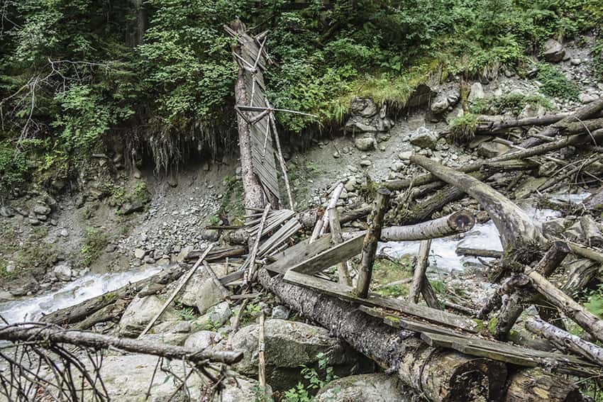
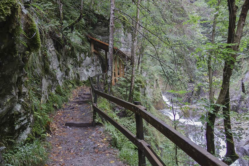
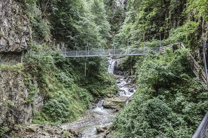
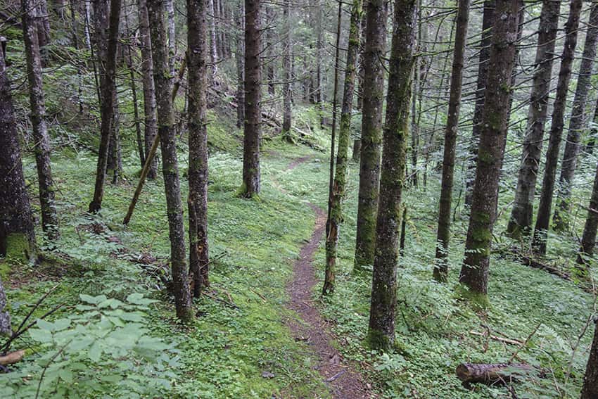
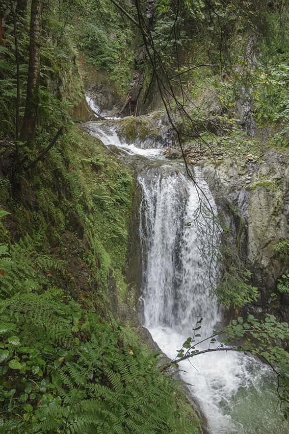
For the loop proposed in this description, the route begins in the village of Valettes/Bovernier at the height of the sports field at rue de l’Oléoduc. Follow this street in a westerly direction to the Oléoduc du Rhône building. Take a path that runs along the gates of the building to go up the Durnand river by the right bank in the direction of the Pont du Durnand. Once at the height of the Gorges du Durnand restaurant, the route is obvious. At the end of the official route continue towards Champex following the Gorges for a distance of 350 meters. When you reach the Route des Valettes, follow it for 350 meters to the first hairpin and take the path that begins at this hairpin (indication PCI CP Martigny 11.2017). Follow this path for 600 meters through a fairly dense forest. Along this portion of the course there are several very slippery wooden footbridges. It is possible to circumvent them upstream without difficulty. At the fork in the path that goes up and down, follow the very steep descent towards the Durnand d’Arpette river. The crossing of the river is done by a footbridge without handrail and very slippery. The author of this description crossed it on all fours!
After the crossing, continue towards the Durnand de la Jure river. The descent is also very steep. This second river is easily forded about 30 meters upstream from the bridge, which is completely destroyed. After the crossing, follow the path uphill for about 400 meters to reach a forest road that descends towards the village of Le Borgeaud. A few meters after the hairpin of the road which is tarred, take a path which descends straight in the direction of Borgeaud. Cross the village and follow the indications of the footpath to reach the starting point.