Honeggerhorn / Risihorn

Location
Haut-Valais, in the Goms valley above the village of Bellwald.

Descriptif
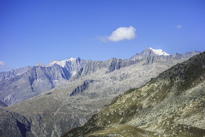
beautiful hike with a panoramic view of the Valais and Bernese Alps. The ascents of Honeggerhorn and Risihorn which can be avoided are rated T4.

Total length
about 9 km

Walking time
about 4 hours

Elevation + et –
+933 m / – 450 m
Altitude: between 2072 and 2874 meters

National hiking map 1:25’000
5004 Berner Oberland

Best period
preferably from June to September when the ski lift facilities are open.

Difficulty
T3 for the whole route and T4 for the ascents (which can be avoided) of the Honeggerhorn and RIsihorn
Useful information
The Furggulti chairlift is open every day in the summer season and on weekends in June and September. The Flesche chairlift is open every day from June to September.
Itinerary
From the village of Bellwald, take the chairlift to reach Flesche, the middle station of the ski lifts and the start of the hike. Head east following the alpine road (for about 200 meters) towards Honeggerhorn and Unnera suon. At the bend in the road, continue straight (east) towards Honeggerhorn and Unnerasuon. Always follow this route to the Spielsee (at altitude point 2248, do not turn left but continue straight ahead in an easterly direction). From the Spielsee. continue towards Mittelsee and Honeggerhorn.
At altitude point 2717, the route joins the Honeggerhorn sign. The summit of Honeggerhorn is to the south of this sign. There is no path to get there, but access is not very complicated. From altitude point 2717 continue west towards Lengsee, Wirbulsee and further towards Risihorn. Unlike the summit of Honeggerhorn, there is a path to the summit of Risihorn which is rated T4. This climb can be avoided by descending south following the very easy ridge which goes to Chuë. Continue towards Furggulti and if the chairlift is open, take it to reach Flesche and then Bellwald.