Le Schwarzhorn

Location
Left bank of the Rhone above Susten-Agarn, at the height of Leuk.

Descriptif
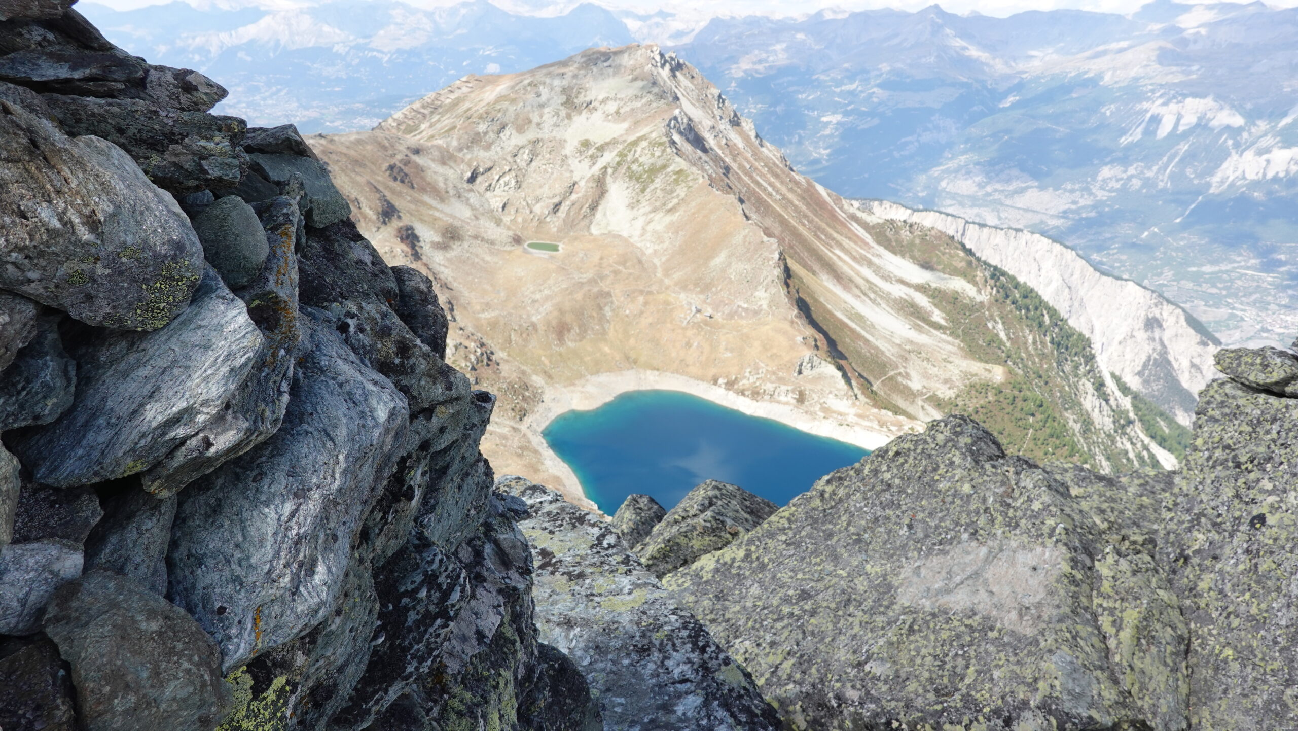
difficult trail going from the plain to the summit of the Schwarzhorn, mainly in T3 and with the ascent of the summit in T4 on small sections. Wild as you want until the Ilsee: you are alone; after… it can change but the view from the summit is breathtaking. Long isolated trail, i.e. bring an emergency pharmacy and means of communication. It’s a bit of an adventure.

Total length
50 km-effort

Walking time
21.25 km

Elevation + et –
+/- 2160 m
Altitude: between 795 and 2786 m

National hiking map 1:25’000
Sierre 1287

Best period
July to October

Difficulty
T3-T4
Useful information
It is imperative, in the event of imminent storms, to find out about the weather forecast. This is a site of European renown not for its charms but for the rock and water material that the Illbach can carry. It then becomes a real trap that can be deadly. Be careful!
Itinerary
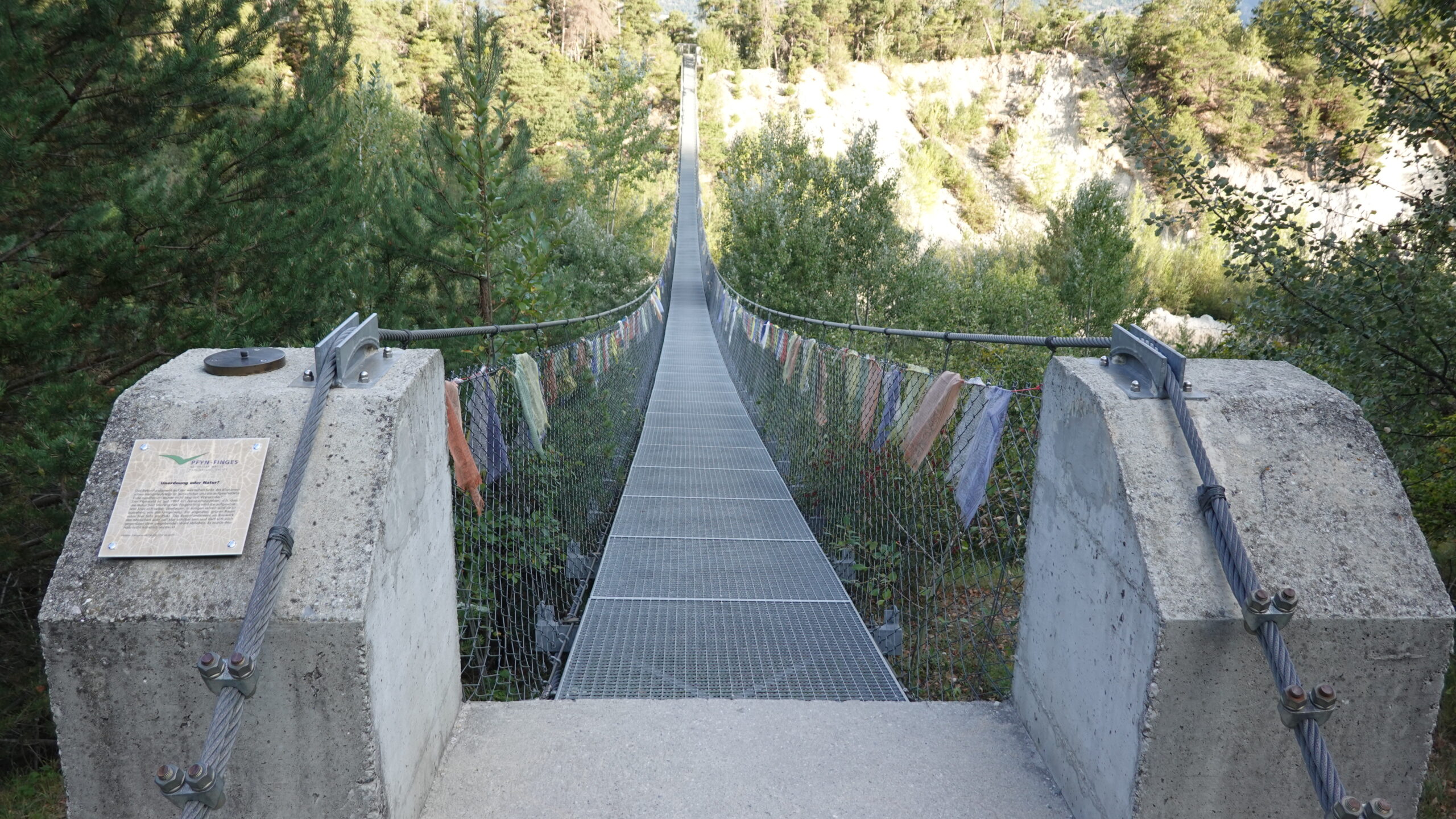
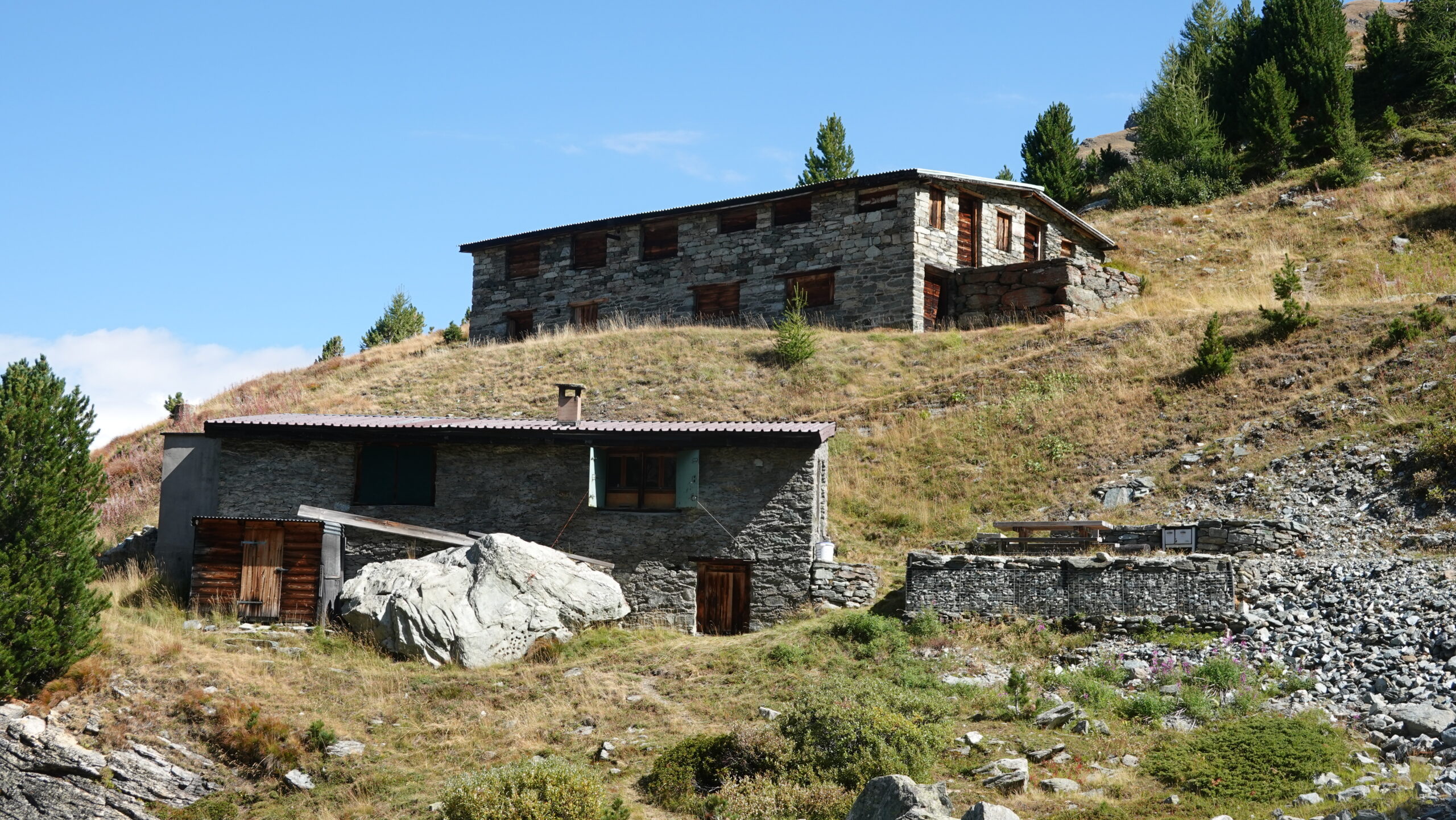
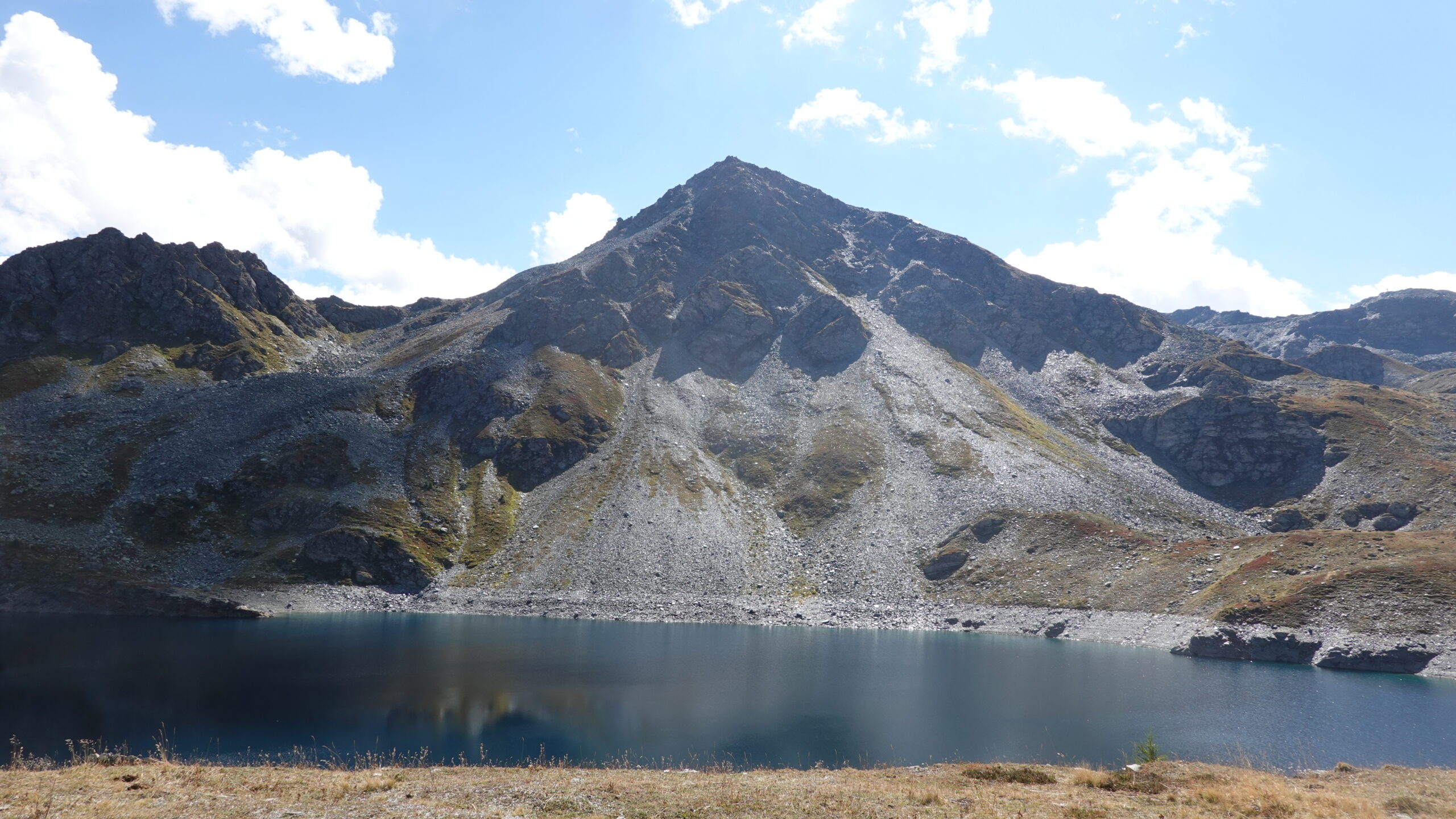
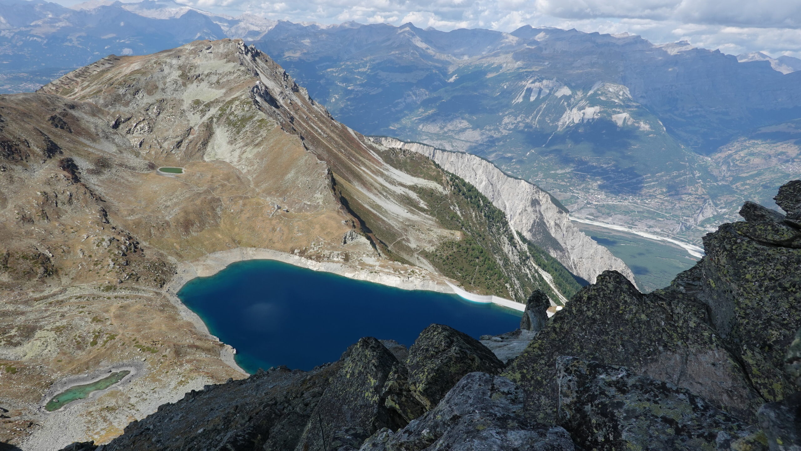
By the cantonal road from Sierre to Susten, reach the parking lot (2,615,175/1,127,060/797 m) of the Bhutan bridge. Take the road that goes up the Illbach torrent (the Illgraben) to Gietji; this is the appetizer. Then follow the white-red-white path that rises so as to quickly stretch your calves. From point 1147 continue on your left to reach the Budilji reservoirs and the two buildings on your left. Continue up to an altitude of 1600 m and look for the path that passes over the Iltötze rocks that overlook you before reaching point 1737. If you miss it, your progress will be through the scree and debris from torrential lava just below the Schwarze Brunnen; and it is very difficult. From point 1737, orientation is easy and the path rises naturally between the rocks to the crown of the Illsee dam. Appreciating the effort made at this stage is already worth it. We continue west, on the dam and we go along the lake by the small path at the bottom which climbs gently towards point 2508, just above the Black Lake. The rest goes via a T4 route which goes due east and marked with blue dots to the summit of the Schwarzhorn. And there you touch Happiness; in principle and if the weather is good.
The descent is not to be neglected especially if the ground is wet. Follow the signs always marked in blue and first reach the dam. A variant goes by a path to the East of the dam, but I will let you discover that one. Then reach Unter Illalpu and finally point 1737. Do not forget to close the various cattle parks on these sections to avoid the wrath of the locals. Enjoy the portion of the path towards point 1720 and from there, beware of the bikes that also have the right to share the route. The rest is regularly indicated by yellow road signs (Wanderweg) and regularly crosses the road that serves the surrounding chalets. The last meters to the starting point still mark the organisms; it is tough.