Sparrhorn

Location
right bank of the Rhone above Blatten bei Naters in the Upper Valais.

Descriptif
easy trail without technical difficulties. Sometimes poorly marked route.

Total length
41 km-effort

Walking time
18.1 km

Elevation + et –
+/- 1,735 m
Altitude: between 1,322 and 3,018 m

National hiking map 1:25’000
Aletschgletscher 1269

Best period
July to September

Difficulty
T3
Useful information
Leave your vehicle at the Blatten cable car parking lot or, better, take public transport.
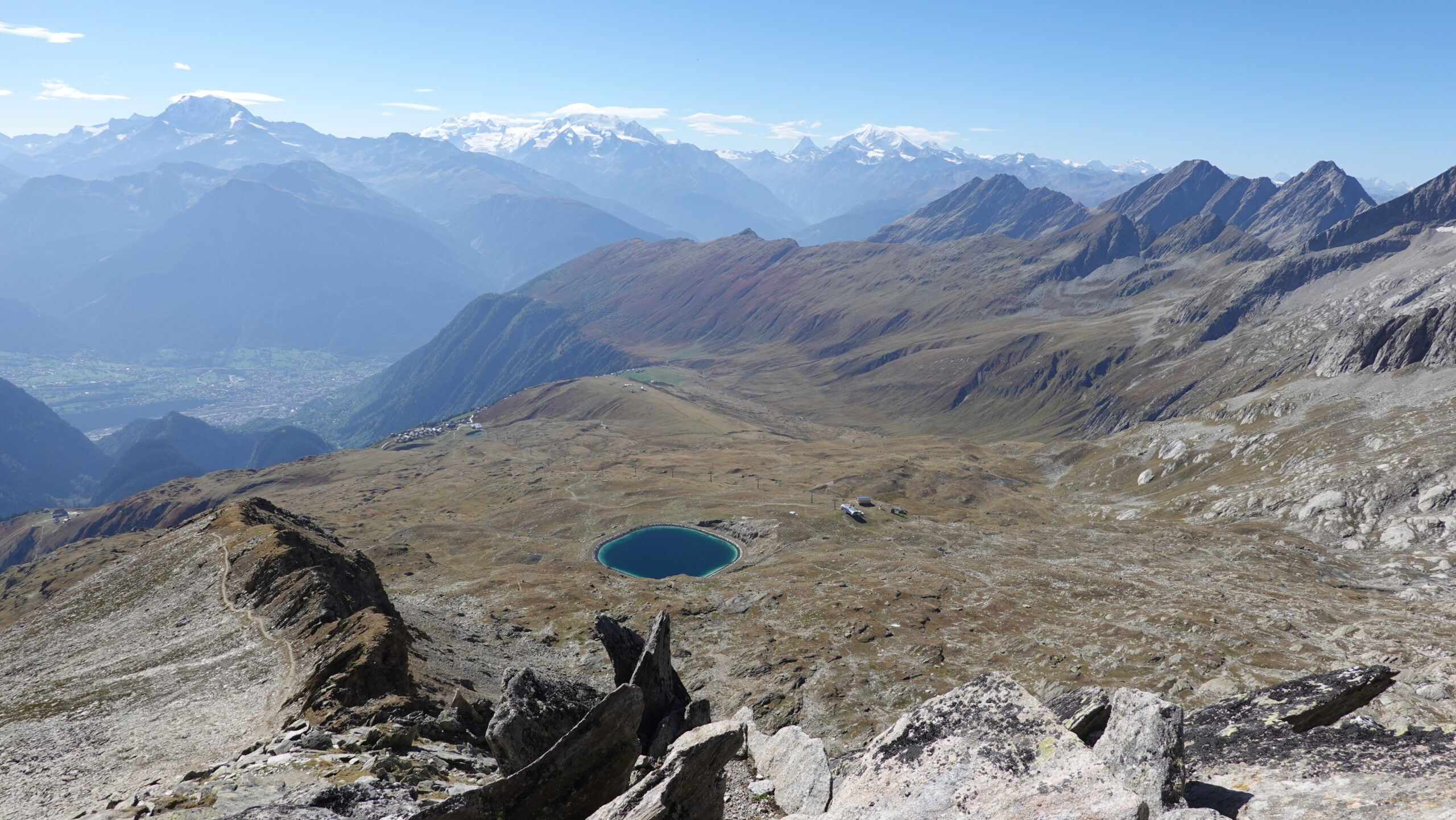
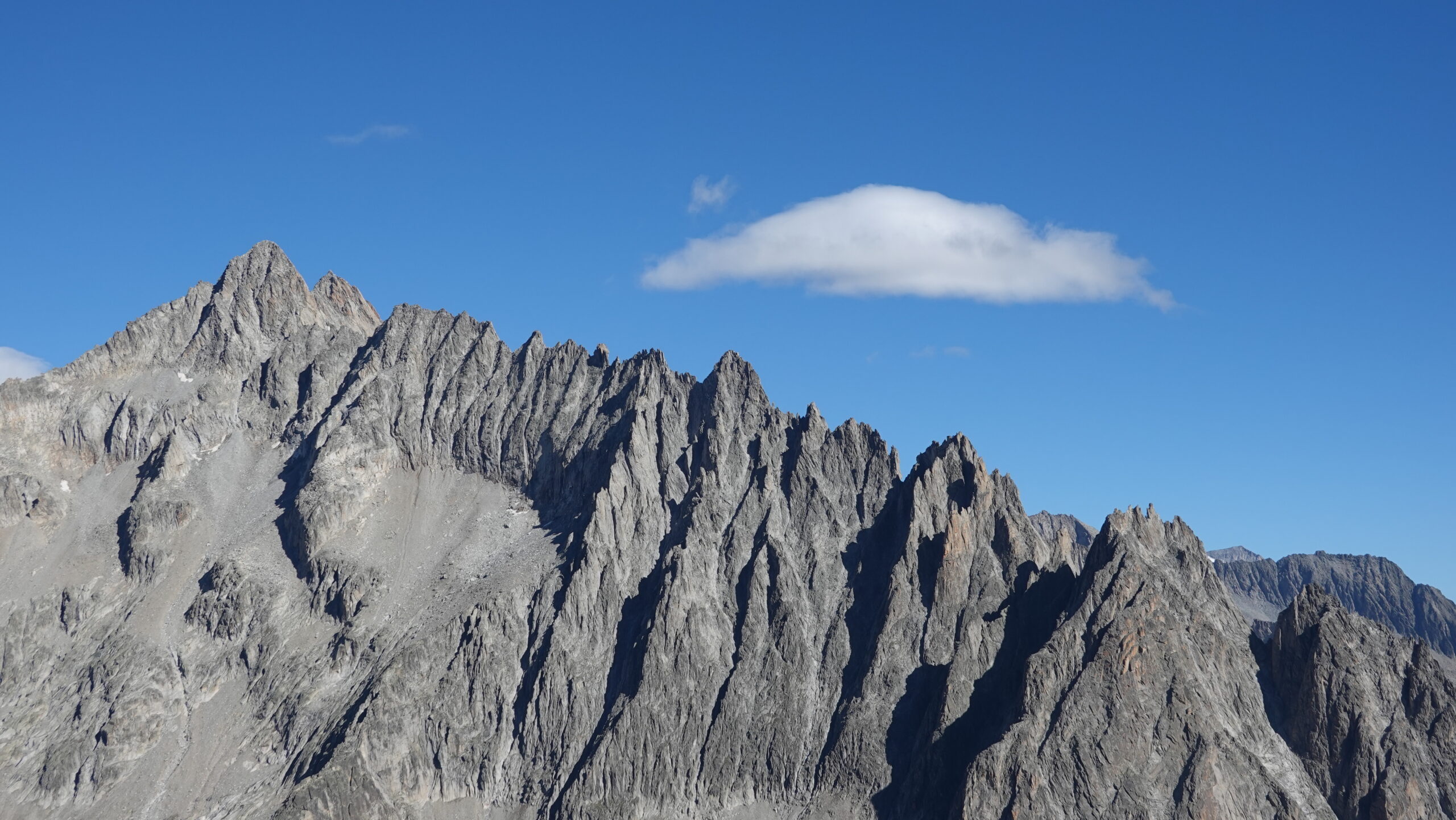
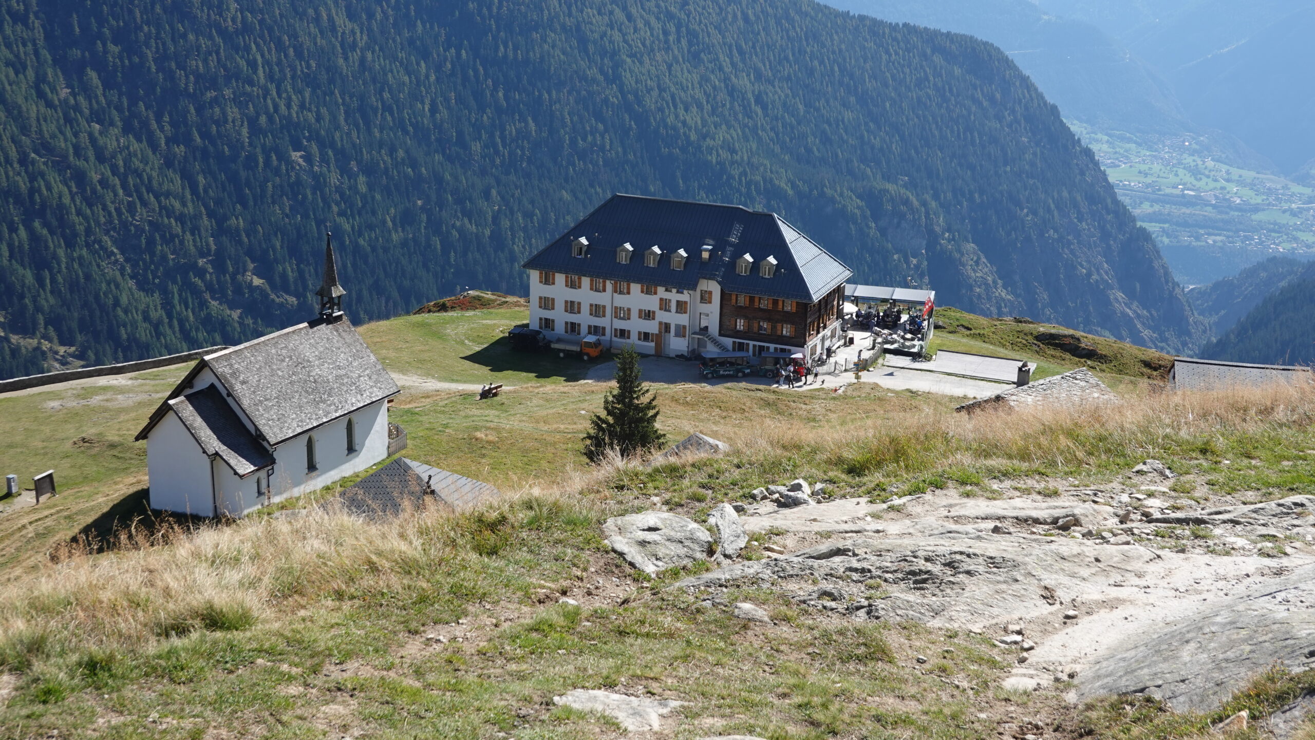
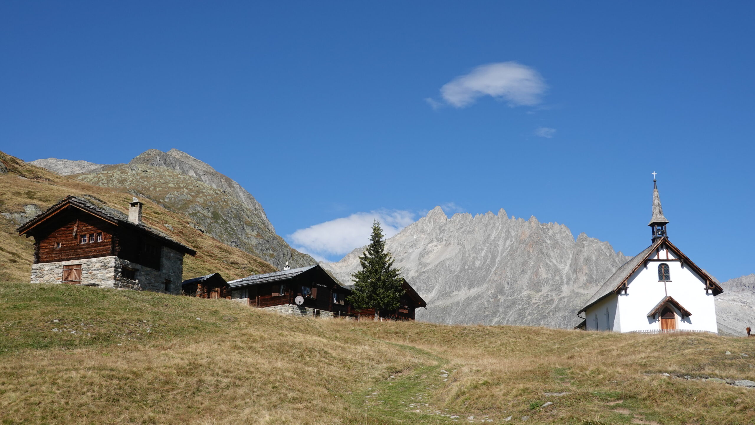
Itinerary
The departure is from the Blatten bei Naters cable car station (2,641,966/1,134,308/1,330 m). Follow the signs for the hiking trails located on the cable car square in a northwesterly direction and quickly take a very pretty stone path leading first to Hasul then Tschuggen and Belalp. At the end of the forest, at an altitude of 1,900 m, continue due north along the facilities leading to Belalp. From the village there are two ways to get around the village: from above to the north to the arrival point of the chairlift at an altitude of 2,299 m or from below to the east to the arrival point of the Blatten gondola. It’s up to you. The two routes meet at point 2478 which is about 120 m higher than the Tyndalldenkmal monument, an imposing monolith seen from afar. The rest of the route generally follows the course of the ski slopes and is not of great interest. This is the dull part of the path. Reach the chairlift arrival at pt 2676 m and go around the water reservoir of a magnificent emerald color to reach the Sparrhorn ridge leading to the summit. Last climb steep but without technical difficulties. The 360° view is breathtaking. To be enjoyed without moderation. The return is made by the same path to pt 2343, at the Tyndalldenkmal monument. Aim for the Belalp Hotel below and stop there even if you are not tired. The place is worth the detour. Continue the descent by a path running under the Belalp Hotel to pt 1904 and turn right to join Egga. The path winds between the last two raccards just before the tarmac road but is not well signposted. Continue your journey to point 1527 at the bridge that spans the Bruchji stream and go down as directly as possible without asking yourself the question of the path that has multiplied like the fish and the loaves of the miracle. There you touch the heights of Blatten and by going around the village from above you will come across your starting point. Nice tour.