Around the Sarine – Hauterive

Location
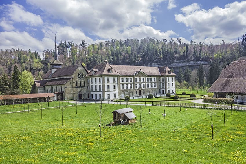
canton of Fribourg, Posieux, Hauterive Abbey

Descriptif
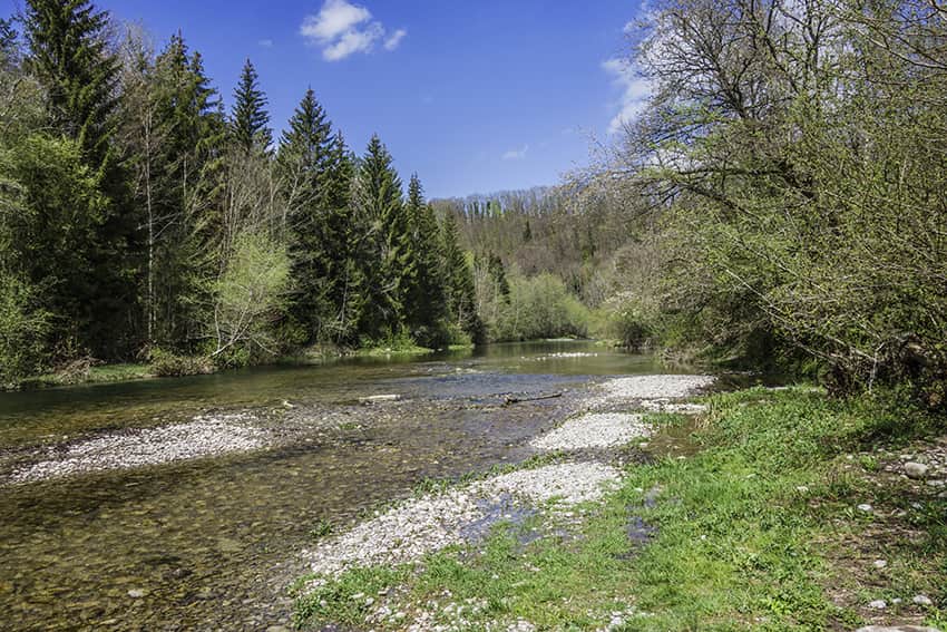
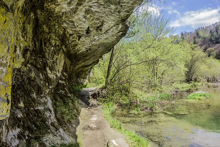
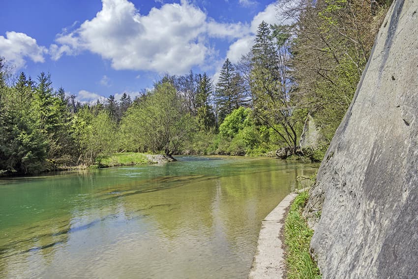
very easy hike along the La Sarine river

Total length
about 10 km

Walking time
about 2-3 hours

Elevation + et –
+/- 261 meters
Altitude: between 576 and 681 meters

National hiking map 1:50’000
252 Bulle

Best period
Can be done a good part of the year. Beware of flooding periods and when the route is snowy

Difficulty
T1
Useful information
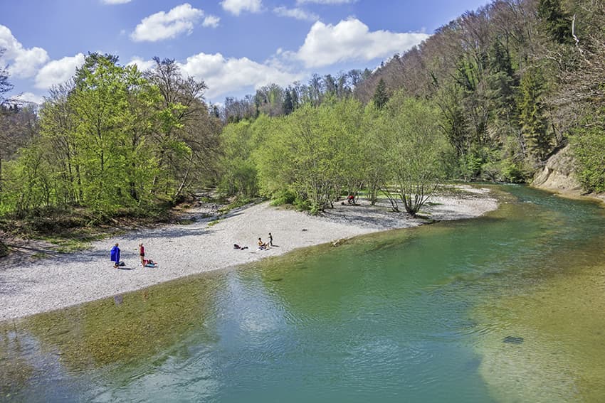
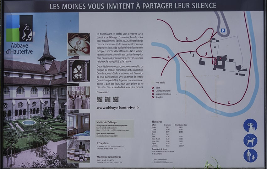
Very nice hike very easy and ideal to do with children. Along the route there are many places to organize a picnic. At the start of the hike and after the bridge near the Abbey of Hauterive (Cistercian order, possibility of buying monastic products, drinks and ice cream. Bring change or pay by TWINT) there is a magnificent place to bask in the sun and for the more courageous to bathe in the river. This place is close to the parking lot and the starting point of the hike.
This hike can be done in either direction.
Itinerary
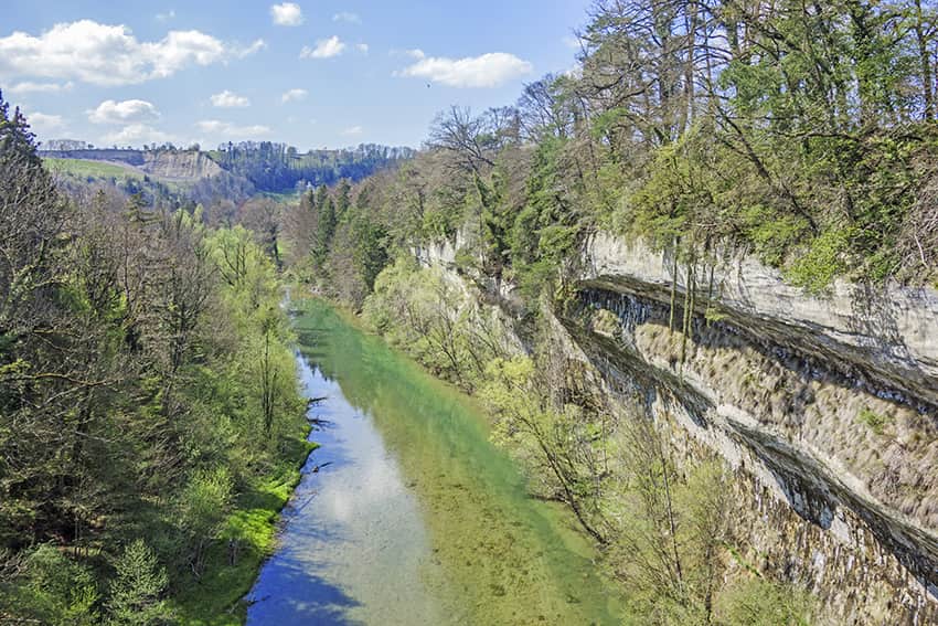
From the Hauterive Abbey car park, follow “Hauterive circuit” crossing the Abbey property to reach the banks of La Sarine. Cross the river bridge and immediately turn right following the river. This detour does not really follow the recommended route for about 1 km. It is more pleasant to follow La Sarine than to go straight up towards the farm and the altitude point 584. However, in itself, this variant joins the basic route. Afterwards, always follow the “Hauterive circuit” along the overhanging La Sarine as far as the road to Cua. Cross the road bridge in the direction of La Tuffière and continue following the route that crosses one block down to La Sarine. This part of the route really follows the banks of La Sarine. On the last third, the path goes up in the forest to reach the starting point.