Fully / Tassonières

Location
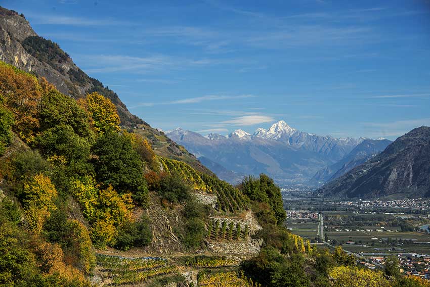
Fully on the right bank of the Rhone

Descriptif
Not very easy hike starting through the famous chestnut grove of Fully and following the vineyards over LA Combe d’Enfer and through beautiful forests of hardwoods. Very beautiful autumn hike.

Total length
about 5 km

Walking time
2 to 3 hours

Elevation + et –
+/-600 meters

National hiking map 1:50’000
272 St Maurice

Best period
in autumn

Difficulty
T3
Useful information
Itinerary
The hike starts at the parking of Fully near the chestnut grove (above LA Belle Usine of Fully). Follow the direction “path vines and sentry boxes” crossing the chestnut (West). After the chestnut grove you join a paved road that climbs into the vineyards. After a few hundred meters, follow “Tassonières”. In the village of Tassonières, cross it following the uphill road to the signposts “Jeur Brûlé, Sex Carro, Champex d’Alesse”. Climb this path that joins the asphalt road. Follow the road for about fifty meters and then the path that goes north uphill (do not follow Jeur Brûlé and Champex d’Alesse). The path crosses a deciduous forest by a fairly steep climb (1 km) and then a very steep descent for about 1 km (thank you good shoes with good soles!). Subsequently the descent is easier (always direction East) to the top of the valley of the Torrent de Fully as you go downhill to your point of departure.