Le Catogne

Location
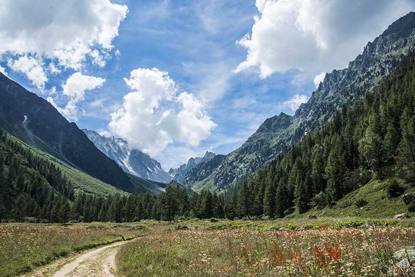
Champex-Lac above Orsières (Val de Ferret), canton of Valais

Descriptif
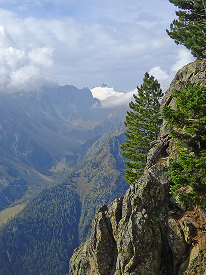
magnificent hike with varied difficulties and landscapes. From the top of Catogne the panorama is just sublime. We can see Martigny and the Rhone plain, the Grand Chavalard, the Pierre Avoi, the Dents du Midi, etc.

Total length
about 12 km

Walking time
about 8 hours

Elevation + et –
+/- 1’714 meters
Altitude: between 1’468 and 2’591 meters

National hiking map 1:50’000
282 Martigny

Best period
from june to october

Difficulty
T4
Useful information
This hike is difficult and requires excellent physical condition to cover it in 8 hours without breaks. After several hours of walking, the T4 rating may seem underestimated and some passages require a very sure foot.
Itinerary
Departure from Champex-Lac (1,471 m), take the path in the center of the village, next to the hotel restaurant Le Vieux Champex, direction Le Catogne (3h50).
The white and red path crosses the last chalets of Champex-Lac before the zigzag climb. At altitude point 1,789 follow north (not direction Belvédère).
The climb is quite steep and rough. There is a passage with chains but no difficulty.
Continue to “Replat du Fratsay” (altitude point 2,271 m) and follow north along the west side of Bonhomme and Pointe de Tsevreresses.
The route crosses some scree which is quite steep and the path can be slippery quickly. Trekking poles are recommended. Again, a few delicate passages with chains, you have to be sure.
From Champex-Lac, the route is very steep, hilly and sustained. As he heads towards Pointe de Tsevreresses, from altitude 2,340 we begin the second difficulty of the course.
After a long climb, the route joins and crosses a scree which leads to the top of Catogne (2,598 m).
The descent towards the North, crosses a scree covered with Lichen, which gives incredible greenish colors. The route then follows a small ridge up to altitude point 2,401. Continue north-east towards altitude point 2,205 to reach the third junction and follow Catogne Alpage – Sembrancher – Bovernier along the eastern side of Catogne and then the Pointe de Tsevreresses.
The trail crosses an old glacial cirque and then pastures slightly uphill to altitude 2,078, from there continue towards Champex-Lac.
The Comba Névi is crossed by a very little marked and hardly visible path. Look out for the red and white markings, so as not to leave the route. After this crossing, the route climbs towards Bonhomme.
The climb is steep, long, difficult and a little dizzying. The trail is not very visible and runs along an impressive slab then follows the east ridge of Bonhomme again. After reaching the Col du Bonhomme, the descent via the Couloir du Frachay is steep and slippery. After 5 to 6 hours of walking this passage is delicate because fatigue can affect concentration. You have to keep your ideas clear.
At the bottom of the corridor, at an altitude of 2,270, the route joins the one at the start of the climb and begins the long descent to Champex-Lac with an 800-meter drop!