Tour des Goli de Brunet

Location
left bank of the Val de Bagnes, above Lourtier and Fionnay from the Marcel Brunet cabin.

Descriptif
difficult hike requiring a good sense of route and very sure footing.

Total length
about 11 km

Walking time
4 to 5 hours

Elevation + et –
+/- 868 m
Altitude: between 2100 and 2881 meters

National hiking map 1:25’000
5003 Mont Blanc – Grand Combin

Best period
May to October. To be avoided in case of fog and snow cover

Difficulty
T4 with no path on certain sections.
Useful information
There is a shuttle that leaves Fionnay for the Brunet hut during the summer season. Mandatory reservation. Out of season, the hut can be reached by private vehicle. The road to the Brunet hut is very well indicated and begins about 2.5 km after the exit from the village of Lourtier.
The portion of the loop route from Pindin is indicated with blue, white markings.
Itinerary
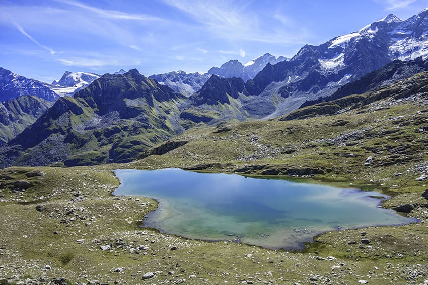
From the Marcel Brunet hut follow the indications “Tour des Lacs”. After about 1 hour of walking, the route arrives at the place called “Pindin”. Follow “tour des lacs” to the right (west) and the blue, white marking which will be the color of the marking for the rest of the hike. It is from “Pindin” that there are some sections without a path. Until « Goli des Otanes » the route crosses several small bodies of water (depending on the progress of the season they will have more or less disappeared). The route continues downstream from the « Goli des Otanes », climbing the ridge to the west to descend the other side towards the « Goli du Rogneux ». Bypass the Goli downstream and continue south to climb the northern foothills of Mont Rogneux to altitude point 2881. Very difficult climb. Once the climb is complete, the descent towards “Pindin and Brunet” is much easier and follows a good path to « Pindin ». Continue towards the Brunet hut and the starting point.