Triftbrücke

Location
Canton of Bern in the Gadmertal on the Susten Pass route

Descriptif
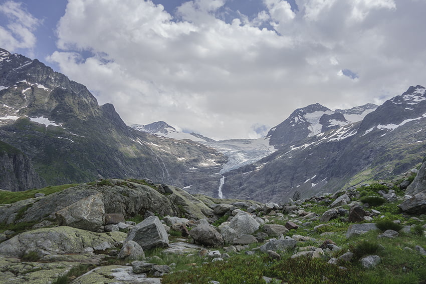
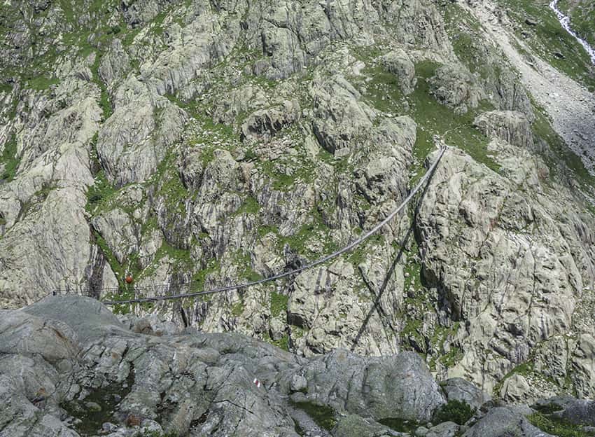
Spectacular hike discovering the Triftbrücke and an easy but dizzying path.

Total length
about 6 km

Walking time
about 3 hours

Elevation + et –
+/- 635 meters
Altitude: between 1357 and 1918 meters

National hiking map 1:50’000
255 Sustenpass

Best period
from mai to october

Difficulty
T3
Bridge length and height: 170 meters / 100 meters
Useful information
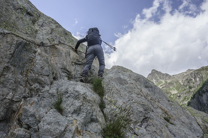
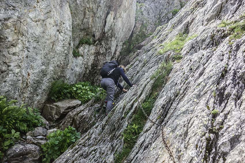
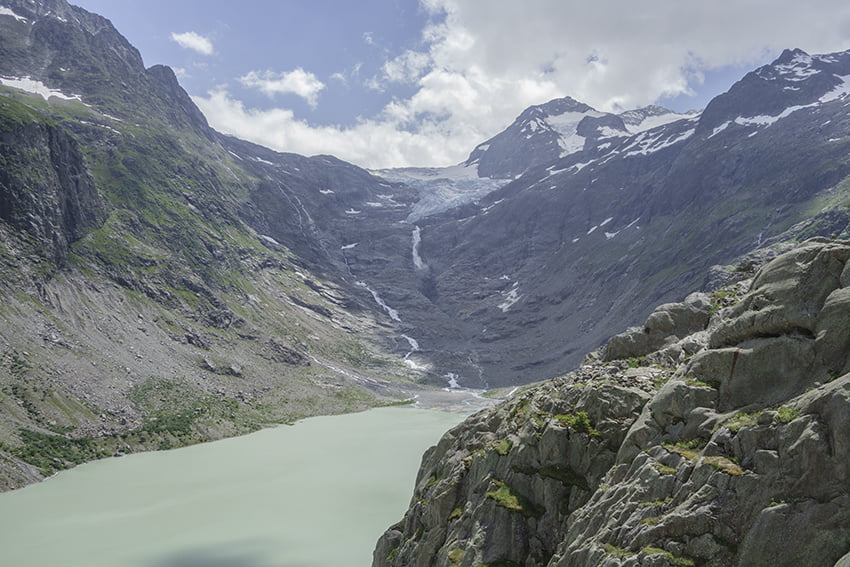
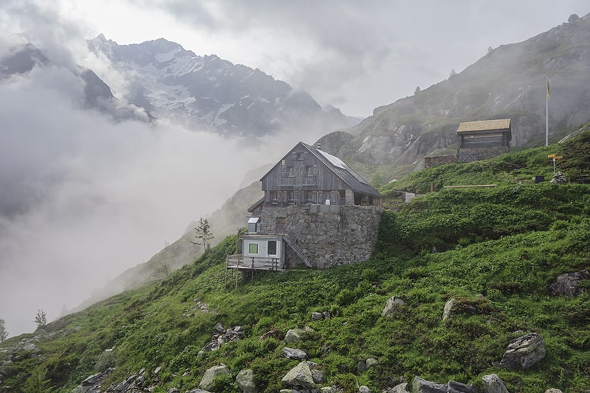
The Triftbrücke and the view of the Triftgletscher are spectacular. For people who are in good physical condition, it is worth taking the Ketteliweg and reaching the WindeggHütte. Very nice little hut to enjoy very good cakes. For climbing enthusiasts, there are many climbing routes all around the cabin of all levels of difficulty, ideal for introducing children to climbing and spending a night in the hut.
To take the Triftbahn cable car, it is imperative to book for the ascent and descent.
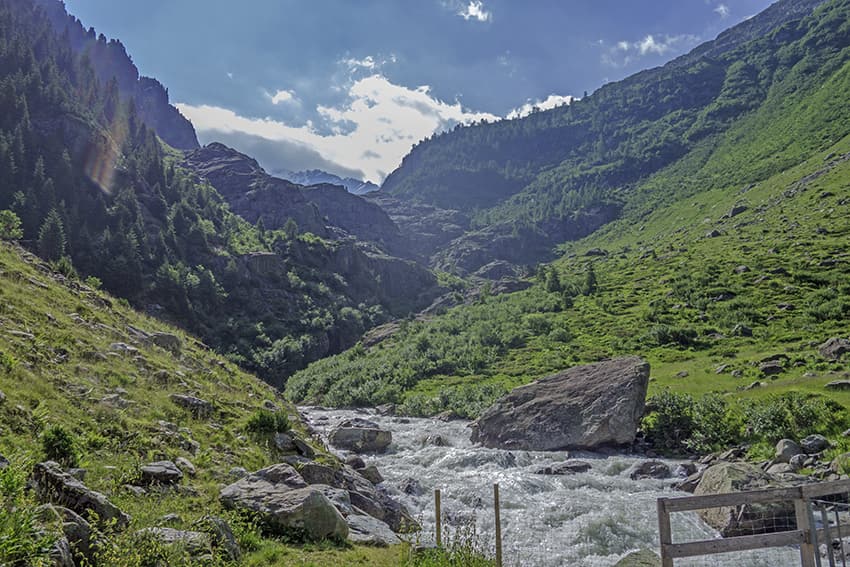
Itinerary
Departure
To reach the Triftbrücke, from Innertkirchen in the Haslital, take the Susten Pass (Gadmertal) road for 8 km to reach the starting station of the Triftbahn cable car (already spectacular).
Itinerary
From the arrival station of the cable car follow Triftbrücke by a path for 3 km. After enjoying the spectacular emotions caused by crossing the bridge, it is possible to continue towards the Windegghütte (30 minutes) by a spectacular path (the aptly named Ketteliweg) equipped with chains in the form of a handrail. Once at the hut, there are two return options, either by the Familenweg (easy but longer), or by the Bosslistein (rather difficult descent, sure foot required) to reach the lower station of the Triftbahn cable car (pay attention to the timetables for the return)