Turtmannhutt

Location
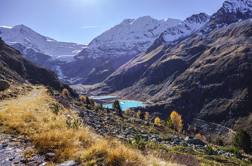
Upper Valais left bank, Turtmanntal

Descriptif
not very difficult hike that takes place in an authentic and preserved valley

Total length
about 11 km

Walking time
about 4 hours

Elevation + et –
+/-750 meters
Altitude:between1900 and 2500 meters

National hiking map 1:50’000
273 T Montana et 274 T Visp

Best period
from the end of April to the end of October

Difficulty
T3
Useful information
In the summer season it is a very busy region. The car park at the start of the hike is chargeable and may be full from 11 a.m. in the morning. The Turtmannhuette is the starting point to reach the Barrhorn which has the distinction of being one of the highest hiking routes in Switzerland (T4)
Itinerary
After reaching the parking lot at the bottom of the Turtmanntal, follow the forest road on the left bank towards the Turtmannsee. Bypass the first lake by the left bank and cross the dyke of the second lake to reach the right bank of the valley. Follow Turtmannhuette, bypassing the last rocky outcrop under the hut to the right to reach altitude point 2431. Then, follow north to reach the hut. After a break during which you can admire the surrounding peaks, continue towards the north to altitude point 2316 and follow the path on the right bank which overlooks the lakes and the valley up to altitude point 2342. Descend towards Holustei (altitude point 2210) and continue descending through a beautiful larch forest to reach the starting point.