Thyon / Dixence

Location
Straddling the Val de Nendaz and the Val d’Hérens

Descriptif
very nice 3-day hike with some summits and several passes to cross

Total length
40 km

Walking time
approx. 14.30 hours (between 4 and 6 hours per day without breaks and photo stops)

Elevation + et –
+/- 2500 meters
Altitude: between 1,124 and 2,987 meters

National hiking map 1:50’000
273 Montan 283 Arolla

Best period
June to September

Difficulty
T3+
Useful information
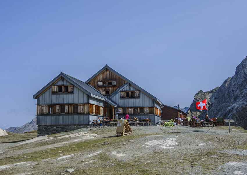
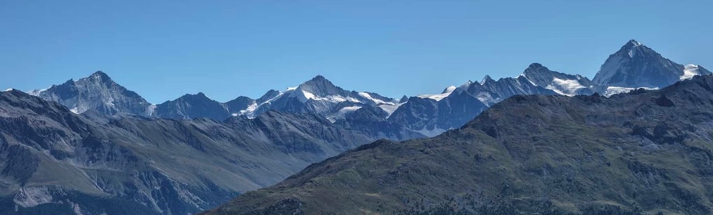
To book the night at the St Laurent hut, it must be done by email (cabane@arpettaz.ch). Stage 2 is strongly discouraged in wet weather, in fog or when the snowpack is heavy. The Hôtel du Barrage de la Grande Dixence is the former accommodation of the workers who built the dam (https://www.hotel-barrage.ch/). In the area between the Prafleuri pass and the Roux pass, you can see many ibex, who are not very shy because they are used to the many hikers who frequent the region. During the first stage, following the Crêtes de Thyon to Crepon Blanc, the panorama is sumptuous.
Itinerary
Stage 1 (Thyon – St. Laurent hut)
14 km, altitude difference +1126 – 764 meters, walking time 5:30
From Thyon 2000, reach the arrival point of the Veysonnaz cable cars and follow the Crêtes de Thyon via the Cheminée route. Continue along the summit of the Crêtes towards Mont Carré, Mont Rouge and Mont Loéré. The route continues up to the pass at the foot of Crepon Blanc, following the Crêtes d’Essertse. From the pass, descend towards the Combatzeline chairlift to follow the route of the old bisse de Chervé to the Cleuson dam. At a place called “La Gouille”, a bridge crosses the valley and the mountain pasture road leads to the St Laurent hut for the end of the first stage.
Stage 2 (Cabane St. Laurent – Grande Dixence dam)
12.5 km, altitude difference +879-1014, walking time 5 hours
From the St. Laurent hut take the direction of the Prafleuri pass. After the Lac du Grand Désert, the route is not very easy to follow (carefully observe the red and white marks). From the bifurcation Col de Prafleuri, Col de Louvie, the route is complicated because it follows an immense scree to the Col de Prafleuri and the path is hardly marked. Without being difficult, this part is technical and requires a seasoned foot to walk. From altitude point 2947 and up to the Prafleuri pass the path is not visible. For the descent from the pass, the first part is quite dizzying and complicated if the path is wet! Follow to the Prafleuri hut and continue towards the Col des Roux for a short climb of 200 meters of vertical drop. From the pass, descend towards the dam and follow the road to the dam wall. Take the Chargeur cable car to reach the Hôtel du Barrage at the bottom of the wall for the end of the second stage.
Stage 3 (Grande Dixence dam – Thyon)
14 km, altitude difference +507 -732 meters, walking time 4 hours
Go up to the top of the dam wall (on foot or by cable car) to follow the route towards Thyon 2000. From the cable car arrival, go down a path that starts at the western corner of the dam wall. From the arrival point of the Alpine Line, go up in the direction of the old Grande Dixence construction huts and cross the valley of the Torrent de Chena. Follow the route that runs along the eastern foothills between Le Métailler and Le Crepon Blanc to the Essertse hut. Take the direction of Mont Côille and continue towards Thyon 2000 to reach the starting point of the route.