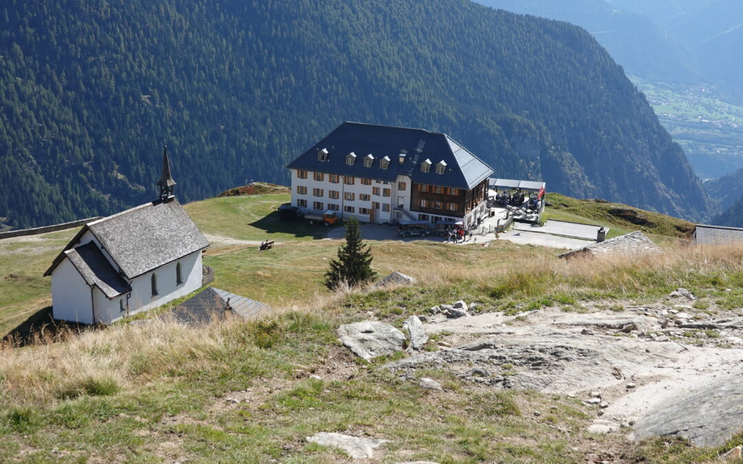
Sparrhorn Location right bank of the Rhone above Blatten bei Naters in the Upper Valais. Descriptif easy trail without technical difficulties. Sometimes poorly marked route. Total length 41 km-effort Walking time 18.1 km Elevation + et – +/- 1,735 mAltitude:...
St Maurice Collonges Location This route runs along the right and left banks of the Rhône between St Maurice and Collonges. Descriptif not easy hiking not recommended for people prone to vertigo and young children. Total length about 14 km Walking time about 4 hours...
St. Cergue / La Dôle Location The Vaudoise coast above Nyon, chain of Jura Vaudois. Descriptif easy hike with an exceptional panorama on Lake Geneva. In good weather we see the water jet Geneva. Total length about 12 km Walking time 4 to 5 hours Elevation + et...
Stägeru and Lüegjeru Location Upper-Valais, on the right bank of the Rhône, between Niedergestelm^n and Gampel Descriptif – Total length about 6 km Walking time about 2 hours Elevation + et – +/- 300 meters Altitude: between 800 and 1000 meters National...
Suspension bridge Belle Etoile Location on the left bank of the Rhône Val d’Illiez – Champéry Descriptif not very easy hike under the Dents du Midi Total length about 8 km Walking time about 3-4 hours Elevation + et – +/- 600 meters Altitude: between 1056 and...
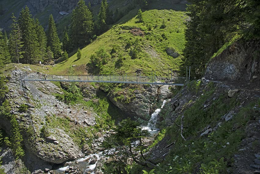
Suspension Bridge Eischoll Location Haut-Valais, left bank above Turtig-Raron Descriptif not very difficult hike with a magnificent and spectacular Suspension bridge Total length about 12 km Walking time about 4 hours Elevation + et – +/-637 meters...