Prarion Location Between Nendaz station and Isérables Descriptif Magnificent autumn hike, discovering larches more than a hundred years old Total length about 7 km Walking time about 3 hours Elevation + et – +/-500 meters Altitude: between 1824 and 2258 meters...
St. Cergue / La Dôle Location The Vaudoise coast above Nyon, chain of Jura Vaudois. Descriptif easy hike with an exceptional panorama on Lake Geneva. In good weather we see the water jet Geneva. Total length about 12 km Walking time 4 to 5 hours Elevation + et...
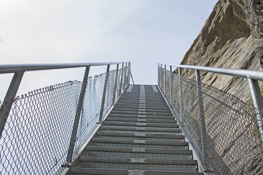
Stägeru and Lüegjeru Location Upper-Valais, on the right bank of the Rhône, between Niedergestelm^n and Gampel Descriptif – Total length about 6 km Walking time about 2 hours Elevation + et – +/- 300 meters Altitude: between 800 and 1000 meters National...
Suspension bridge Belle Etoile Location on the left bank of the Rhône Val d’Illiez – Champéry Descriptif not very easy hike under the Dents du Midi Total length about 8 km Walking time about 3-4 hours Elevation + et – +/- 600 meters Altitude: between 1056 and...
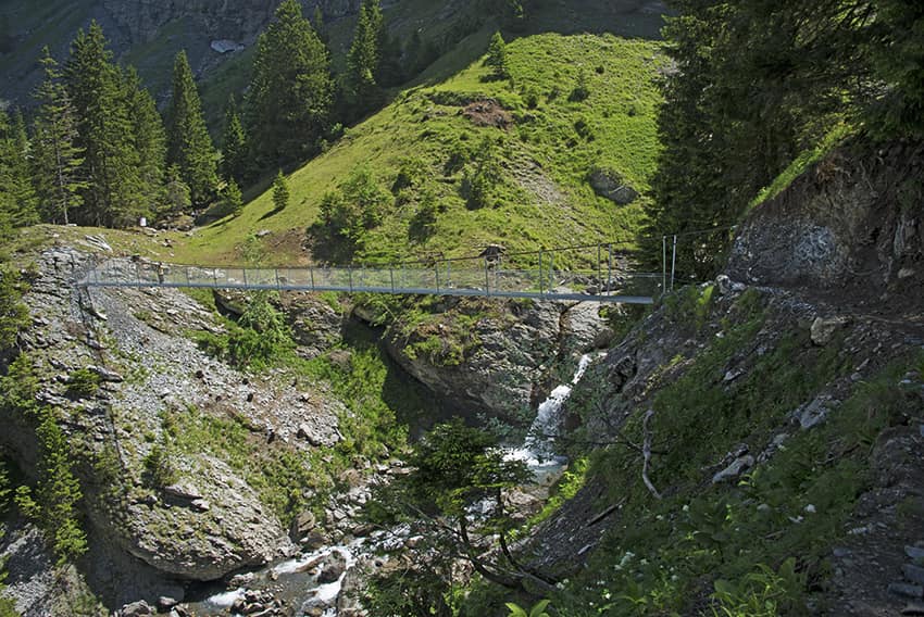
Suspension Bridge Eischoll Location Haut-Valais, left bank above Turtig-Raron Descriptif not very difficult hike with a magnificent and spectacular Suspension bridge Total length about 12 km Walking time about 4 hours Elevation + et – +/-637 meters...
Suspension bridge Farinet Location Saillon on the right bank of the Rhone between Martigny and Sion Descriptif Beautiful hike in the footsteps of the famous counterfeiters and / or anarchist of the first hour Joseph-Samuel Farinet Total length about 7 km Walking time...