Prarion Location Between Nendaz station and Isérables Descriptif Magnificent autumn hike, discovering larches more than a hundred years old Total length about 7 km Walking time about 3 hours Elevation + et – +/-500 meters Altitude: between 1824 and 2258 meters...
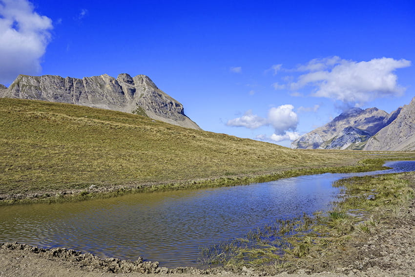
Prarochet Hut Location Sanetsch Pass, above Sion. On the right bank of the Rhone. Descriptif easy hike, in a slightly lunar landscape with a magnificent panorama of the Valais Alps. Total length about 9 km Walking time about 3 hours Elevation + et – +/-360...
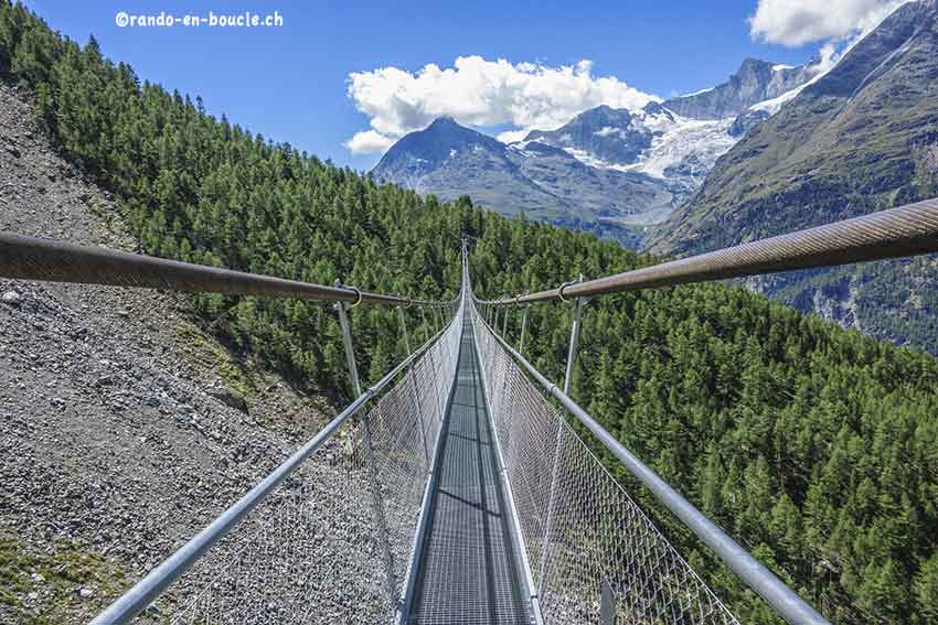
Randa / Suspension Bridge Location Randa above Visp in the Zermatt valley Descriptif easy marked hike! But with a significant difference in altitude over a very short distance to reach one of the longest suspension bridges in Switzerland. (about 600 meters long)...
Romainmôtier Location Romainmôtier in northern Vaud Descriptif very easy hike along the La Dard river Total length about 11 km Walking time about 3 hours Elevation + et – +/-270 meters Altitude: between 550 and 720 meters National hiking map 1:50’000 251 La...
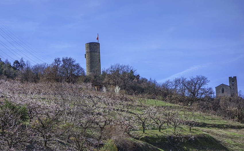
Saxon Sentier des abricots Location Village of Saxon on the left bank of the Rhône plain Descriptif hike not too difficult to do in March when the apricot trees are in bloom Total length about 5 km Walking time about 2 hours Elevation + et – +/- 342 meters...