Vaud
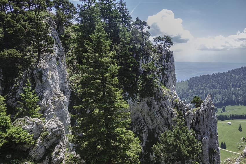
Aiguilles de Baulmes
LocationCanton of Vaud – near Ste Croix, YverdonDescriptif not too difficult hike with a magnificent panorama of the Alps and Lake Neuchâtel on a clear day.Total lengthabout 11 kmWalking timeabout 4 hoursElevation + et -+/-683 meters Altitude: between 1014 and 1558...
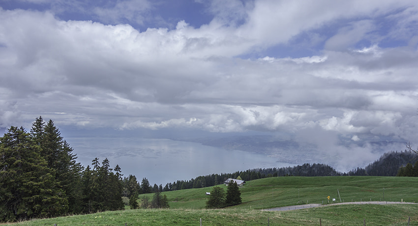
Caux / Rochers de Naye
LocationCaux above Montreux and GlionDescriptif difficult hike during which you admire the panorama on Lake Geneva, the Riviera and Chablais.Total lengthabout 11 kmWalking timeabout 5 hoursElevation + et -+/- 900 metersNational hiking map 1:50’000 262 T Rochers de...
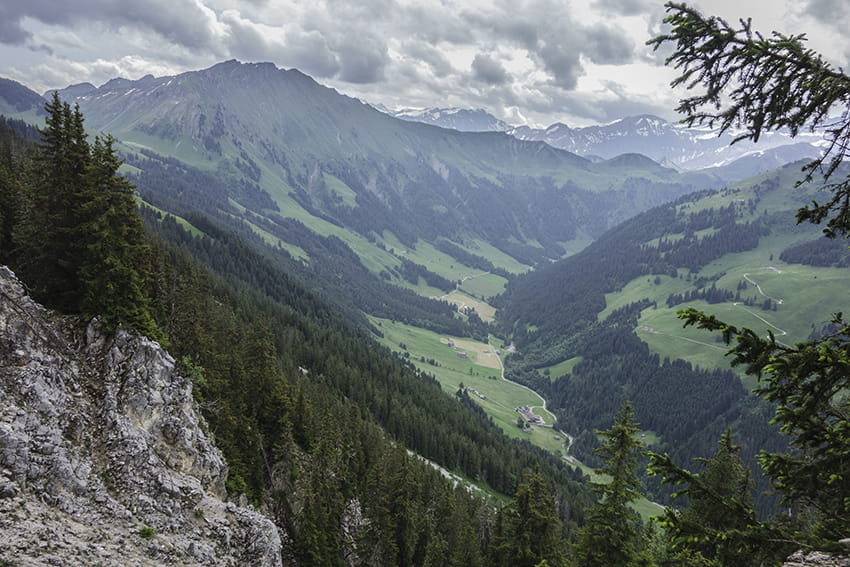
Col de Jaman / Bonaudon
LocationCaux region, Rochers de Naye above the Vaud RivieraDescriptif Difficult walk in a very beautiful area. Typical route of the pre-Alps.Total lengthabout 13 kmWalking timeabout 4 to 5 hoursElevation + et -+/- 824 meters Altitude: between 988 and 1755...
Col de la Croix / Bretaye
Locationcanton of Vaud, between Villars and Les DiableretsDescriptif easy hike. No problem. Varied and typical landscapes of the region.Total lengthabout 13 kmWalking time4 hoursElevation + et -+/-500 metersNational hiking map 1:50’000 St Maurice 272 TBest periodMay...
Corbeyrier / Les Agittes
LocationCanton of Vaud in Chablais above YvorneDescriptif challenging hike, requiring sure footing. Not recommended for people suffering from vertigo. Avoid in very humid or rainy weather. In good weather, magnificent view of Lake Geneva.Total lengthabout 9 kmWalking...

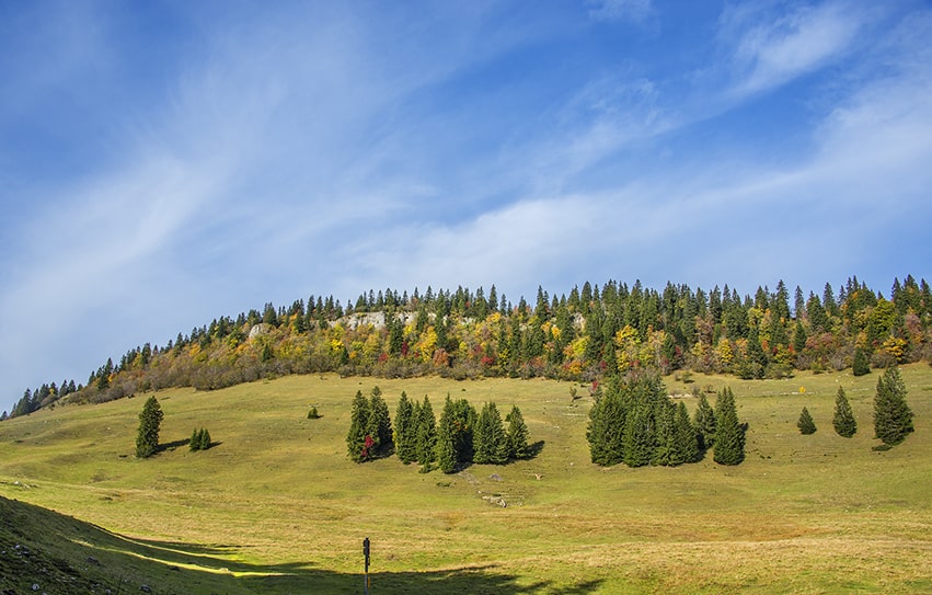
Haut du Mollendruz
Locationcol du Mollendruz, VaudDescriptif Beautiful hike with beautiful panoramas on Lake Geneva, the lakes of Joux, Brenet and the valley of Joux.Total lengthabout 11 kmWalking timeabout 3-4 hoursElevation + et -+/- 425 meters Altitude: between 1103 and 1439...
Joux lake tour
LocationValley of Joux, Jura VaudoisDescriptif easy hiking with no particular problem around the largest mountain lake in the Jura. Discovering forest landscapes, green pastures and freshness of the water.Total lengthabout 22 kmWalking time5 to 6 hoursElevation + et...
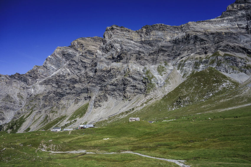
L’Etivaz / Plan de la Douve
LocationCanton of Vaud on the Château-d’Oex side of the Col des Mosses.Descriptif challenging hike. Sustained climb to the Douve refuge and very steady climb from the refuge to Plan de la Douve. Avoid for people prone to vertigo. The first 100 meters of the descent...

Les Pléiades / La Neuve
LocationAbove Vevey and Villard-sur ChambyDescriptif easy hike, between deciduous forest and flower meadowsTotal lengthabout 9 kmWalking timeabout 3 hoursElevation + et -+/-430 meters Altitude: between 1’150 and 1’500 metersNational hiking map 1:50’000 262 Rochers de...

Luan / Berneuse
LocationLuan above Yvorne and CorbeyrierDescriptif difficult hike, typical of the Vaudois Alps (steep climbs and descents)Total lengthabout 10 kmWalking timeabout 5 hoursElevation + et -+/-900 metersNational hiking map 1:50’000 272 St Maurice and 262 Rochers de...

Mont Pèlerin
LocationMont Pèlerin above Vevey, ChardonneDescriptif easy hike, between deciduous forest and flower meadowsTotal lengthabout 10 kmWalking timeabout 3 hoursElevation + et -+/-420 meters Altitude: between 850 and 1’100 metersNational hiking map 1:50’000 262 Rochers de...
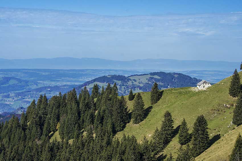
Mont Sâla
LocationJura Vaudois, region Bassins, ArzierDescriptif easy hike, typical Jura topography. Magnificent views of Lake Geneva and Geneva’s water jet from the top of Mount SâlaTotal lengthabout 15 kmWalking timeabout 4 hoursElevation + et -+/-493 meters Altitude: between...
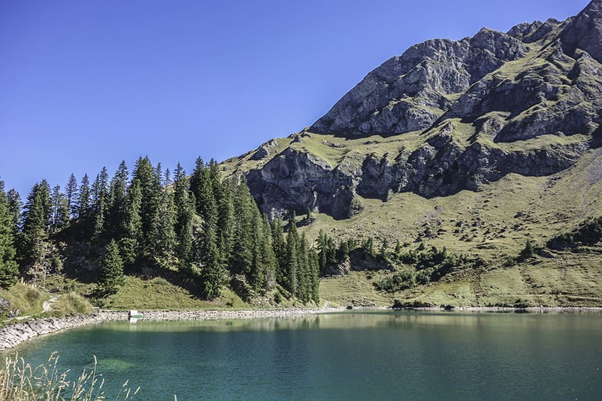
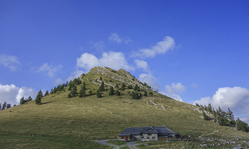
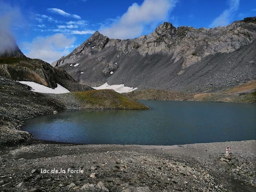
Pic Chaussy
LocationVaud Alps, Col des Mosses, Lioson d’En BasDescriptif not very difficult hike with the discovery of a magnificent mountain lake and a 360° panorama from the summit of Pic ChaussyTotal lengthabout 7 kmWalking timeabout 4 hoursElevation + et -+/- 730 meters...

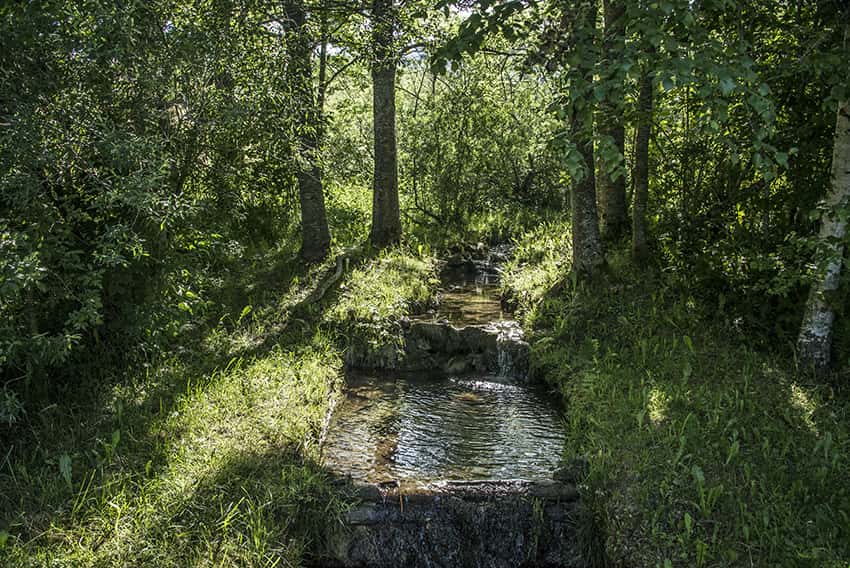
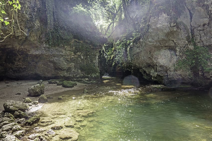
Romainmôtier
LocationRomainmôtier in northern VaudDescriptif very easy hike along the La Dard riverTotal lengthabout 11 kmWalking timeabout 3 hoursElevation + et -+/-270 meters Altitude: between 550 and 720 metersNational hiking map 1:50’000 251 La SarrazBest periodall...
Solalex / Col de Poreyrette
LocationSolalex, Vaud Alps, above BexDescriptif very difficult hike with an extremely vertiginous passage in the downhill of the Poreyrette pass. Not recommended for people prone to vertigo. To travel only in dry weather.Total lengthabout 7 kmWalking timeabout 3...

St. Cergue / La Dôle
LocationThe Vaudoise coast above Nyon, chain of Jura Vaudois.Descriptif easy hike with an exceptional panorama on Lake Geneva. In good weather we see the water jet Geneva.Total lengthabout 12 kmWalking time4 to 5 hoursElevation + et -+/-750 metersNational hiking map...
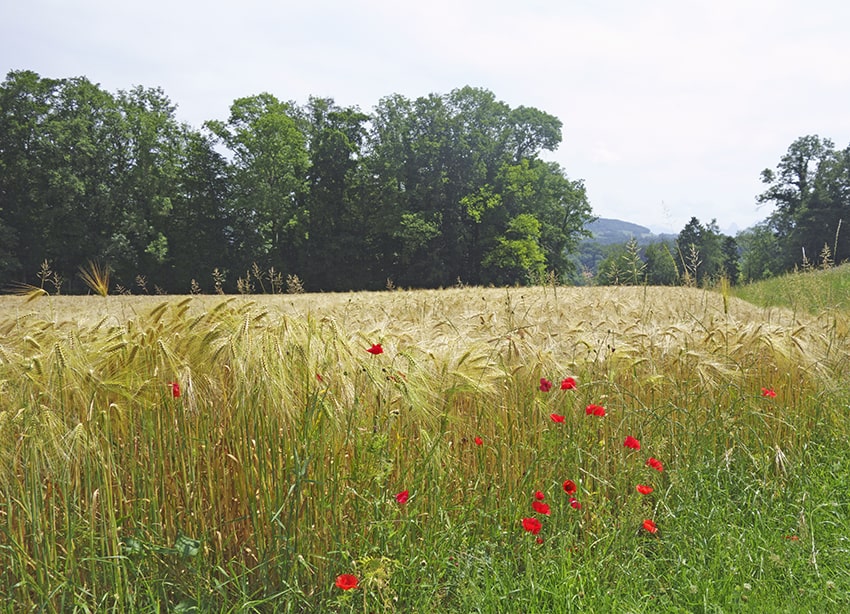
Tine de Conflens
LocationCanton of Vaud between Cossonay-ville and La SarrazDescriptif beautiful easy hike between deciduous forest and rapeseed fieldsTotal lengthabout 16 kmWalking timeabout 4 hoursElevation + et -+/-300 meters Altitude: between 436 and 593 metersNational hiking map...
Tour (Tower) de Gourze
LocationPuidoux-Chexbres in the canton of VaudDescriptif Easy hike to do with children. Very popular on weekends.Total lengthabout 10 kmWalking timeabout 3 hoursElevation + et -+/- 440 meters Altitude: between 616 and 925 metersNational hiking map 1:50’000 261...

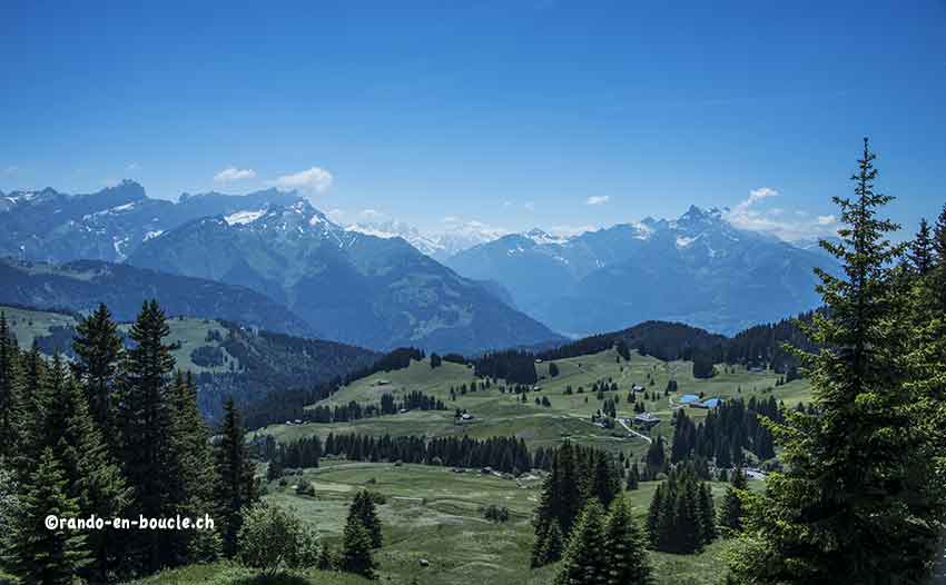
Tour de Famelon
LocationVaud Alps – between Le Sépey and Lac de l’HongrinDescriptif not too difficult hike with a magnificent panorama of the Valais and Fribourg Alps.Total lengthabout 8 kmWalking timeabout 3 hoursElevation + et -+/-624 metersAltitude: between 1659 and 2127...
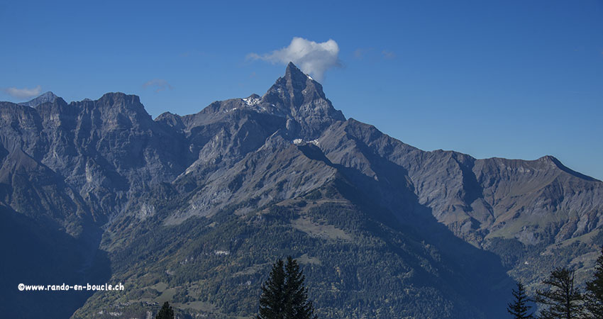
Tour de l’Argentine
LocationSolalex above VillarsDescriptif difficult hike, to discover the chain of Argentina and its famous mirror popular with mountaineers. Typical itinerary of the Vaud Alps region.Total lengthabout 13 kmWalking time5 to 6 hoursElevation + et -+/-1000 metersNational...
Tour de la Palette
LocationVaudois Alps – Les Diablerets – Pillon PassDescriptif not difficult hiking in the beautiful environment of the Vaud Alps. This hike can be undertaken in both directions: direction Isenau or direction Col du Voré.Total lengthabout 7 kmWalking time2 to 3...
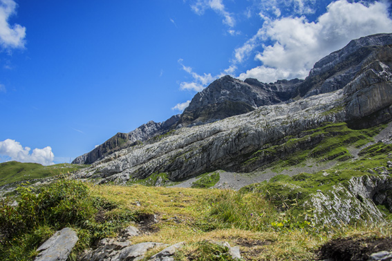
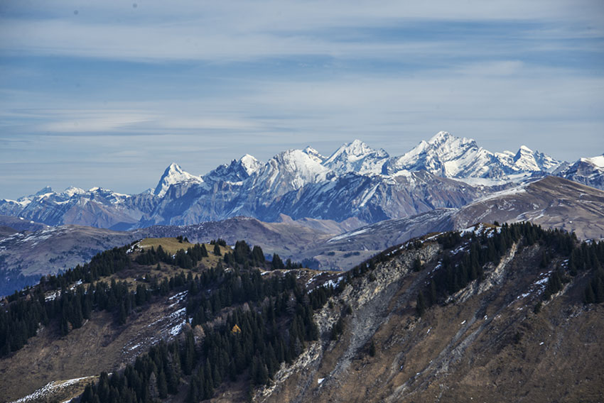
Tour des Muverans
LocationStraddling the cantons of Vaud and Valais, between the massifs of Argentine and the Muverans.Descriptif Magnificent hike with sumptuous panorama and the ascent of the Grand Muveran.Total lengthabout 33 kmWalking timeabout 16 hoursElevation + et -+/-3’283...
Tourche hut
Locationin line with Lavey-les-Bains, Morcles, right bank of the RhôneDescriptif not difficult trek without particular problem. Very nice hike with a magnificent panorama on the region of Chablais and Lake Geneva.Total lengthabout 8 kmWalking time2 to 3 hoursElevation...