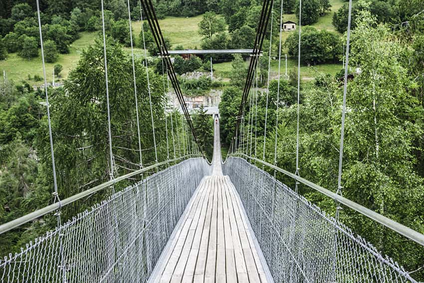
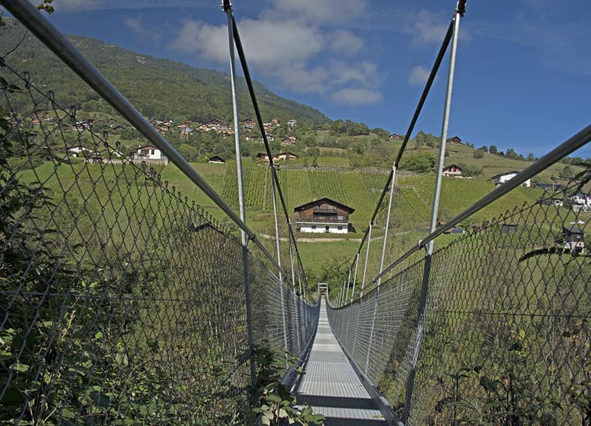
Suspension Bridges
Aspi Titter suspension bridge
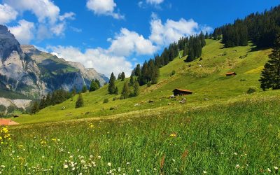
LocationValley of Conches, villages of Fiesch, Egga, Ried, BellwaldDescriptif Beautiful hike in a region that exudes serenity and authenticityTotal lengthabout 7 kmWalking timeabout 2-3 hoursElevation + et -+/- 550 meters Altitude: between 1323 and 1827 metersNational...

Bouthan bridge Susten
LocationForest of Finges (Pfnywald) SustenDescriptif very easy hike, which crosses a magnificent pine forestTotal lengthabout 6 kmWalking timeabout 2 hoursElevation + et -+/-230 meters Altitude: between 630 and 850 metersNational hiking map 1:50’000 273 T MontanaBest...
Bridge Belalp – Riederalp
LocationUpper-Valais, Goms Valley, between Riederalp and BelalpDescriptif Hike in the beautiful Aletsch Glacier region.Total lengthabout 11 kmWalking timeabout 4-5 hoursElevation + et -+926 / -758 meters Altitude: between 1500 and 2133 meters Bridge length and...
Bridge Chenarlier – Troitorrents
LocationTroistorrents above MontheyDescriptif -Total lengthabout 2,5 kmWalking timeabout 1 hoursElevation + et -+/-230 meters Altitude: about 700 meters Bridge length and height: 185 meters / 75 metersNational hiking map 1:50’000 272 St MauriceBest periodpractically...
Flüekapelle / Dala
LocationUpper Valais left bank, TurtmanntalDescriptif easy hike that winds through the cool Dala River GorgeTotal lengtheasy variant about 5 km, variant 2 about 7 kmWalking timeeasy variant approx. 2 hours, variant 2 about 3 hoursElevation + et -easy variant +/- 330...
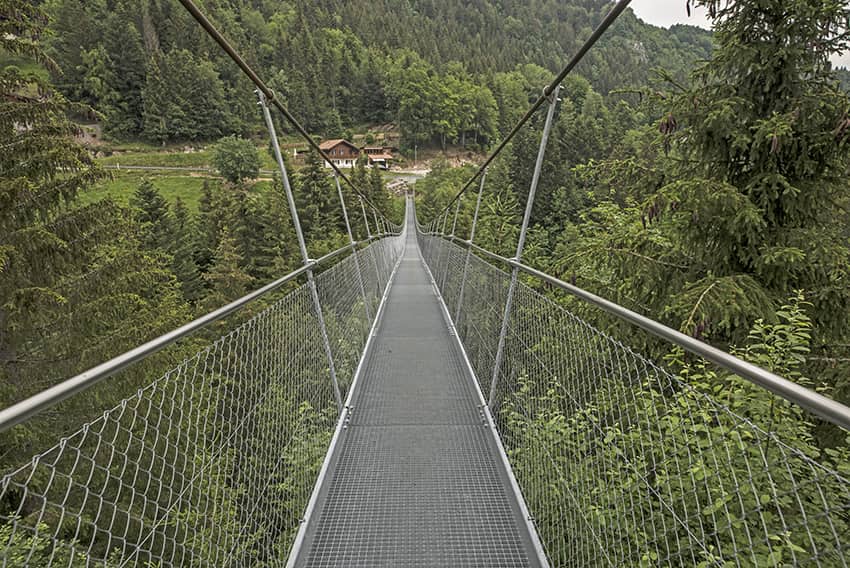
Gateway Naters
LocationUpper-Valais, Naters, BrigDescriptif nice sunny hike. In addition to the footbridge, some very well secured air passages.Total lengthabout 5 kmWalking timeabout 2 hoursElevation + et -+/-425 metersAltitude: between 700 and 1000 metersNational hiking map...

Gümmenen / BE
LocationCanton of Bern near MühlebergDescriptif very easy loop hike around the Saane (Sarine) in a countryside settingTotal lengthabout 11 kmWalking timeabout 3 hoursElevation + et -+/-134 meters Altitude: between 463and 535 metersNational hiking map 1:50’000 242...
L’Ertense / bisse du Rho
LocationCrans- Montana, Ertense valleyDescriptif nice hike with some very dizzying passagesTotal lengthabout 13 kmWalking timeabout 4 hoursElevation + et -+270 meters -1’020 meters Altitude: between 1’500 and 2’25’ metersNational hiking map 1:50’000 273 MontanaBest...
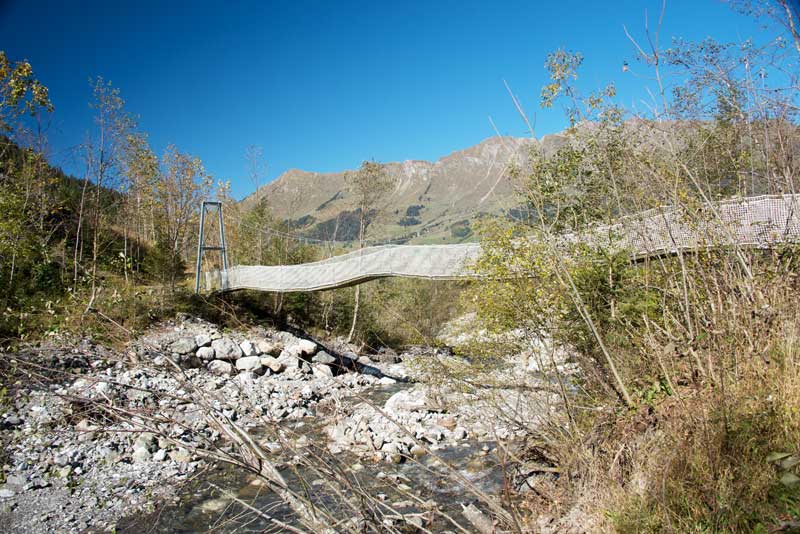
La Monta – Arolla
LocationVal d’Hérens, village of ArollaDescriptif easy hikeTotal length7 kmWalking time2-3 hoursElevation + et -+/- 317 metersAltitude: between 1,794 and 1,937 meters Length and height of the bridge: 75 and 20 metersNational hiking map 1:50’000 283 ArollaBest...

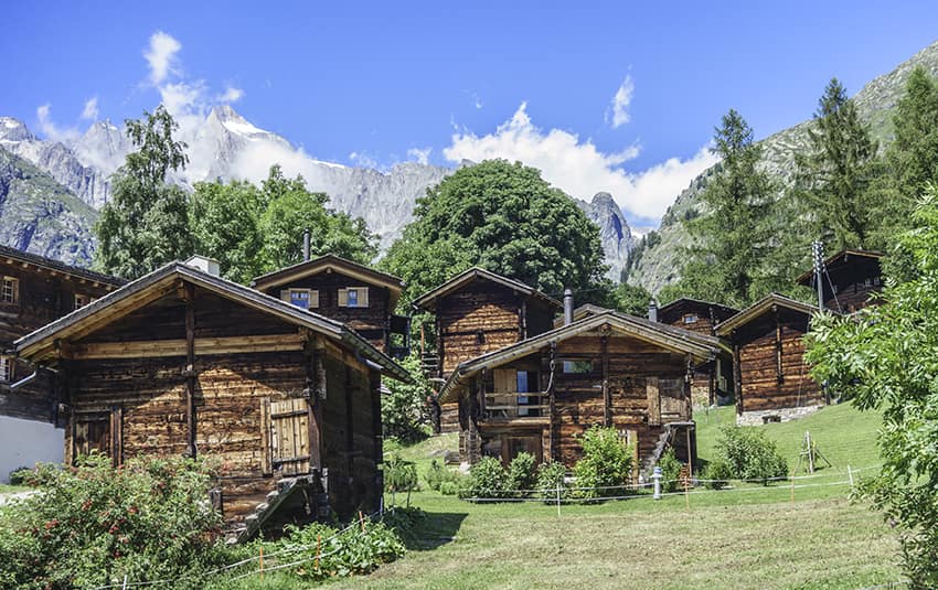
Montsalvens Lake
LocationCharmey canton of Fribourg on the Jaun Pass roadDescriptif very easy hike. Ideal for accustoming young children to the pleasure of walking.Very beautiful landscape and during the beautiful days, many places to organize a picnic. Also possibility to frequent...

Panossière and Brunet hut/ (VS)
LocationFionnay Val de Bagnes, direction Mauvoisin damDescriptif difficult hike with some vertiginous passages, is done in two days.Total lengthabout 24 kmWalking timeabout 12 hoursElevation + et -approx. 2,300 metersNational hiking map 1:50’000 283 T ArollaBest...
Pont Turrian
LocationChâteaux d’Oex, Vaud AlpsDescriptif pretty loop hike around the SarineTotal lengthabout 5 kmWalking time2 hoursElevation + et -+/- 140 metersNational hiking map 1:50’000 262 Rochers de NayeBest periodMay to OctoberDifficulty-Length and height of the bridge: 45...
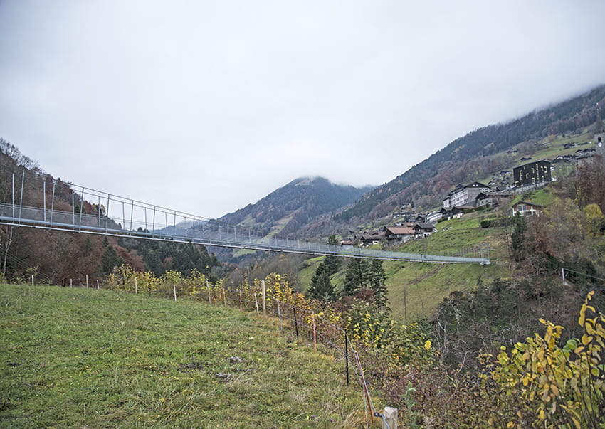
Randa / Suspension Bridge
LocationRanda above Visp in the Zermatt valleyDescriptif easy marked hike! But with a significant difference in altitude over a very short distance to reach one of the longest suspension bridges in Switzerland. (about 600 meters long)Total lengthabout 6 kmWalking...
Stägeru and Lüegjeru
LocationUpper-Valais, on the right bank of the Rhône, between Niedergestelm^n and GampelDescriptif -Total lengthabout 6 kmWalking timeabout 2 hoursElevation + et -+/- 300 meters Altitude: between 800 and 1000 metersNational hiking map 1:50’000 274 VispBest periodfrom...
Suspension bridge Belle Etoile
Locationon the left bank of the Rhône Val d’Illiez – ChampéryDescriptif not very easy hike under the Dents du MidiTotal lengthabout 8 kmWalking timeabout 3-4 hoursElevation + et -+/- 600 meters Altitude: between 1056 and 1554 metersNational hiking map 1:50’000 272 St...
Suspension Bridge Eischoll
LocationHaut-Valais, left bank above Turtig-RaronDescriptif not very difficult hike with a magnificent and spectacular Suspension bridgeTotal lengthabout 12 kmWalking timeabout 4 hoursElevation + et -+/-637 meters Altitude: between 1097 and 1596 metersNational hiking...
Suspension bridge Farinet
LocationSaillon on the right bank of the Rhone between Martigny and SionDescriptif Beautiful hike in the footsteps of the famous counterfeiters and / or anarchist of the first hour Joseph-Samuel FarinetTotal lengthabout 7 kmWalking time2 to 3 hoursElevation + et...
Suspension bridge Furgangen
LocationUpper-Valais, Goms valley, after the village of Fiesh, on the main road at the junction for Bellwald. (parking on site)Descriptif -Total lengthabout 9 km for the route of the bisse TruseraWalking timebetween 2 and 3 hours depending on the route chosenElevation...
Suspension bridge Gorges de la Vièze
LocationUnder – Valais, city of MontheyDescriptif -Total lengthabout 6 kmWalking timeabout 2 hoursElevation + et -+/- 284 meters Altitude: between 465 and 656 metersNational hiking map 1:50’000 272 St MauriceBest periodfrom april to octoberDifficultyT2Bridge length...
Suspension bridge Grande Combe
LocationSt Martin on the left bank of the Rhone in Val d’HérensDescriptif easy hike with a spectacular passage of a suspension bridge and visit the hamlet of OssonaTotal lengthabout 9 kmWalking timeapprox. 3 hoursElevation + et -+/-650 metersNational hiking map...
Suspension bridge La Jorette
LocationUnder – Valais, Torgon above VionnazDescriptif -Total lengthaccording to the planned route about 3 kmWalking timeaccording to the planned route approx. 1 hourElevation + et -+/-118 meters Altitude: between 1121 and 1187 metersNational hiking map 1:50’000 272...
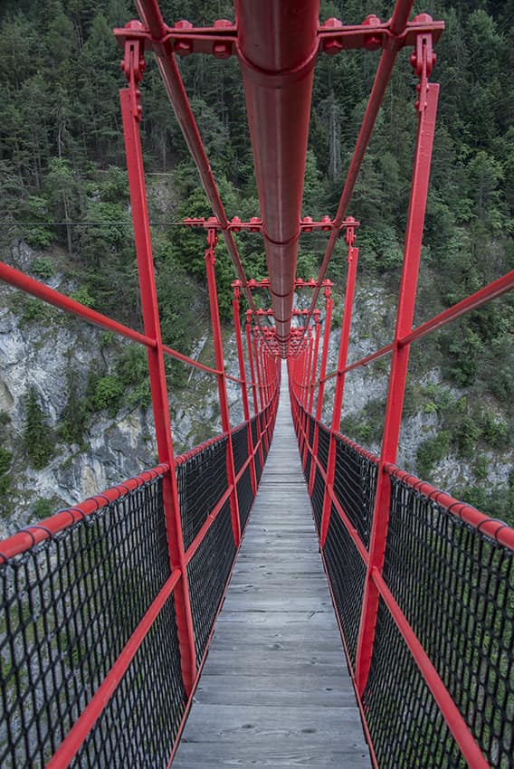
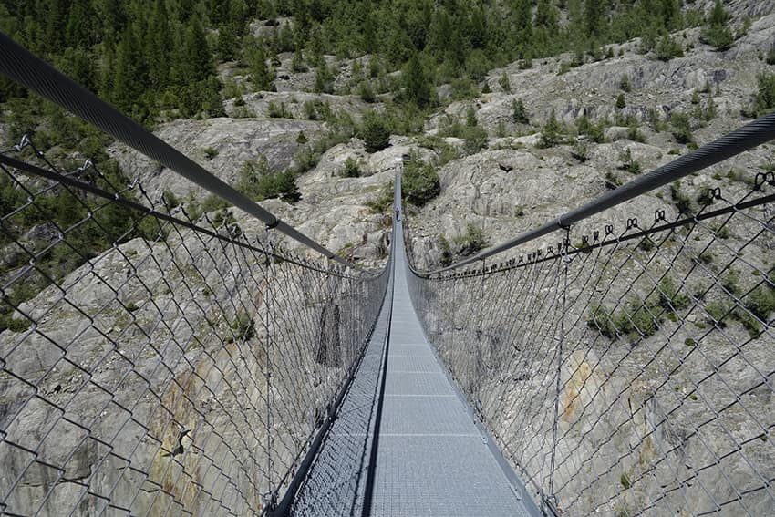
Suspension bridge Niouc
LocationNiouc, Val d’AnniviersDescriptif -Total length-Walking time-Elevation + et -Altitude: 900 metersNational hiking map 1:50’000 -Best period-Difficulty-Length and height of the suspension bridge: 200 meters and 190 metersUseful informationPrint itinerary...
Suspension bridge of Léderrey – Les Diablerets
LocationLes Diablerets – Vaud AlpsDescriptif easy hike along the Grande Eau river. Ideal for families with young children.Total lengthabout 5 kmWalking time1 to 2 hoursElevation + et -+/-110 metersNational hiking map 1:50’000 St Maurice 272Best periodMay to...
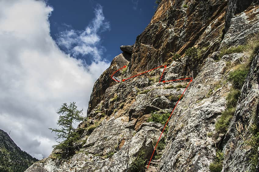
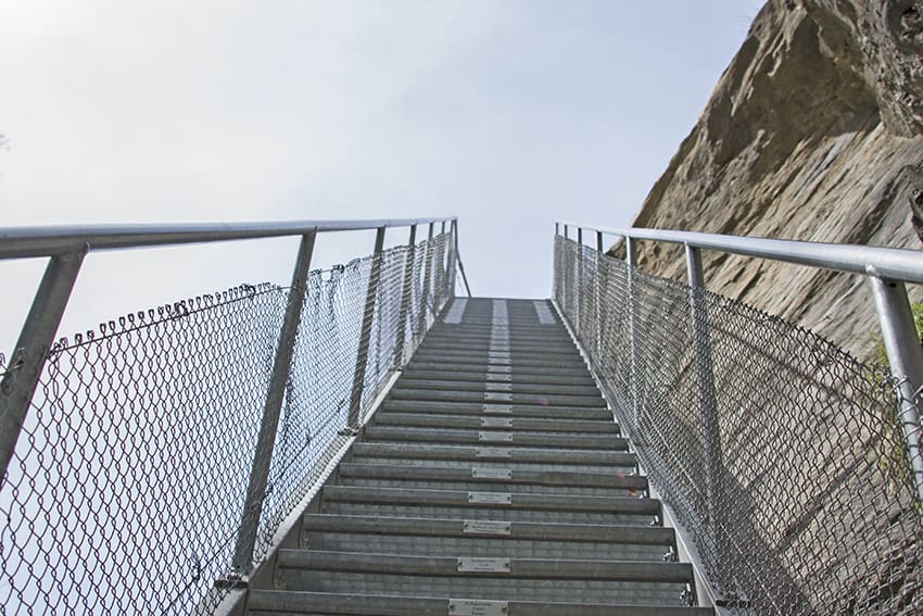
Suspension bridge Saas Almagell
LocationSaas Valley, Upper Valais, from Visp follow Zermatt, Saas Fee and then Saas AlmagellDescriptif Spectacular hike that begins by taking a vertiginous rock face (very well secured) and crossing 3 suspension bridges. The first two (respectively 60 and 45 meters...

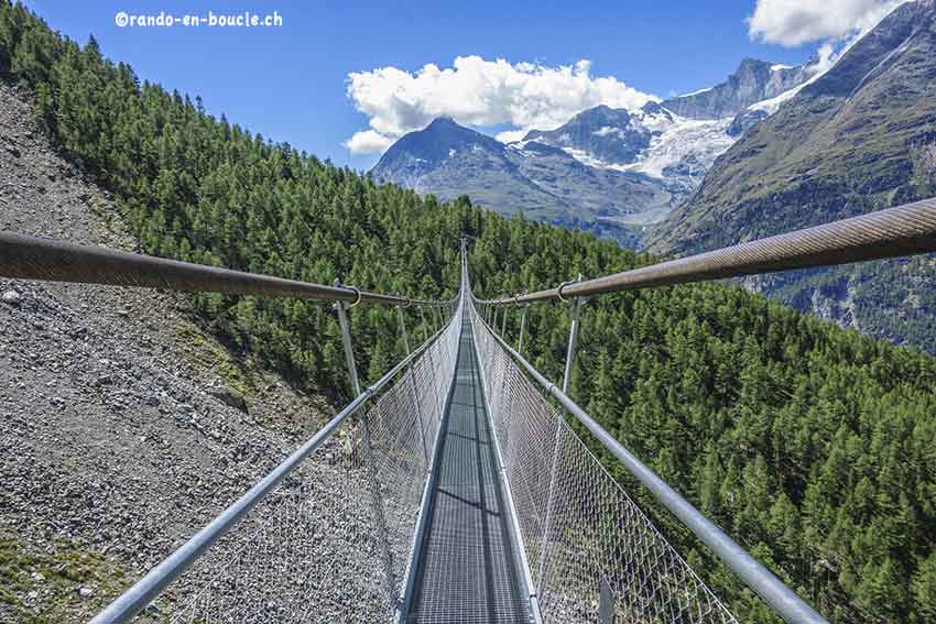
Suspension bridge Zermatt
LocationZermattDescriptif very easy hike in the magnificent Zermatt region and its mythical mountain the MatterhornTotal lengthabout 6 kmWalking timeabout 2 hoursElevation + et -+163 / -411 meters Altitude: between 1619 and 1959 metersNational hiking map 1:50’000 284...

Torrent Neuf / Savièse
LocationSavièse on the right bank of the Rhône above SionDescriptif no particular difficultyTotal lengthabout 5 kmWalking timeabout 2 hoursElevation + et -+/- 200 meters Altitude: between 1100 and 1300 metersNational hiking map 1:50’000 273 MontanaBest periodfrom June...
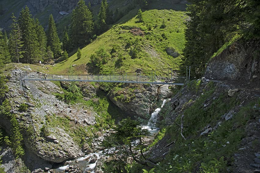
Triftbrücke
LocationCanton of Bern in the Gadmertal on the Susten Pass routeDescriptif Spectacular hike discovering the Triftbrücke and an easy but dizzying path.Total lengthabout 6 kmWalking timeabout 3 hoursElevation + et -+/- 635 meters Altitude: between 1357 and 1918...
Tseuzier / Lac du Rawil
LocationTseuzier in the town of Ayent on the right bank of the Rhône from SionDescriptif very easy hike. Ideal for accustoming young children to walk in the mountains. They can get used to the altitude, walk on paths that have all the characteristics of a mountain...
Tsina di Vio / Grand Mountet/
LocationVal d’Anniviers from ZinalDescriptif -Total lengthabout 11 kmWalking time-Elevation + et -Altitude: between 1,700 and 2,900 metersNational hiking map 1:50’000 no. 283 ArollaBest periodfrom June to SeptemberDifficulty-Length and height of the footbridge: 45 m....